Malpaís de Güímar 2
Technical information
- Start: Malpaís de Güímar 1, km 1.8
- Finish: Malpaís de Güímar 1, km 2.5
- Approval status: Not officially approved
- Degree of difficulty: Low
- Type of trail: Linear
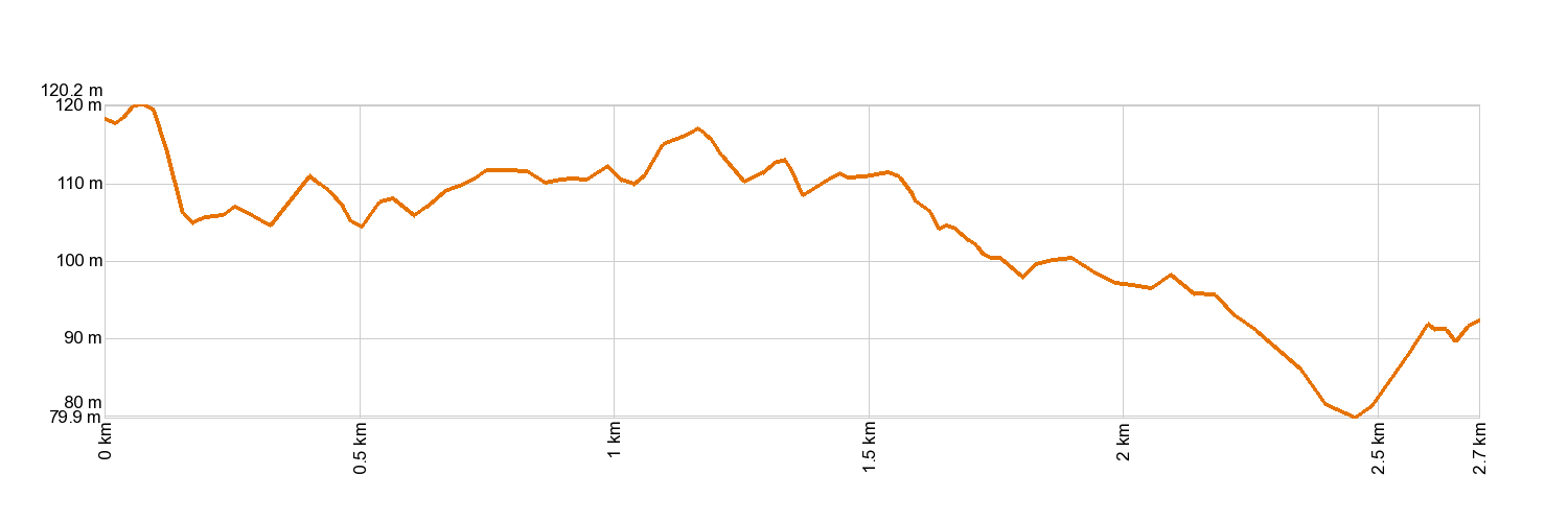
- Distance: 2.7 km (12.89 ft)
- Duration: 1 hour
- Highest altitude: 117 m (12.89 ft)
- Lowest altitude: 80 m (12.89 ft)
- Elevation gain: 38.6 m (12.89 ft)
- Elevation loss: 60.9 m (12.89 ft)
- Links to other trails:
- Protected Nature Areas:
- Authorisation required: No
Trail description
This trail journeys around Montaña Grande and can be taken as an extension to the Malpaís de Güímar 1 route. The Malpaís de Güímar is a special nature reserve of great ecological significance that was declared a protected area in 1987. This is a unique volcanic landscape that spans all the way from Montaña Grande to the coast. The region's mild climate makes it a wonderful habitat for a great many endemic species. Cardons and tabaibas thrive here. Nearer the coast, you will find sea fennel and the local species of sea lavender, while the sandy areas are populated by spiny broom bushes and Canarian clovers, with over 60 species of lichens dotted all over the Malpaís landscape. All across the inland area of El Malpáis are a series of volcanic tubes and caves. The most spectacular ones are the caves of Cueva Honda and Cueva de los Burros, with some stretches measuring as long as 100 m (330 ft) and as tall as 5 m (16 ft). The best way to discover this landscape is to explore its trails and stop at its many lookout points, where tongues of lava, cardons and tabaibas dominate the scenery. We welcome you to take it all in slowly on a leisurely walk.
Hypsometry
For your own safety, don't forget to check the condition of the trail.
The competent authority will be responsible for informing you if the trail is not recommendable in the wake of adverse weather conditions, as well as if the trail or part of it is closed, etc.
- Competent authority: Güímar Town Council
- About the competent authority: Malpaís de Güímar 2
![]() In case of an emergency, call 112.
In case of an emergency, call 112.
Download FRESS 112, available for iOS and Android
Weather Today
Maximum: 22º
Minimum: 17º
Güímar. Sunny skies all Thursday long. Temperatures will remain unchanged.