PR-TF 59 Las Portelas - Masca
Technical information
- Start: Las Portelas
- Finish: Masca
- Approval status:
- Degree of difficulty: Low
- Type of trail: Linear
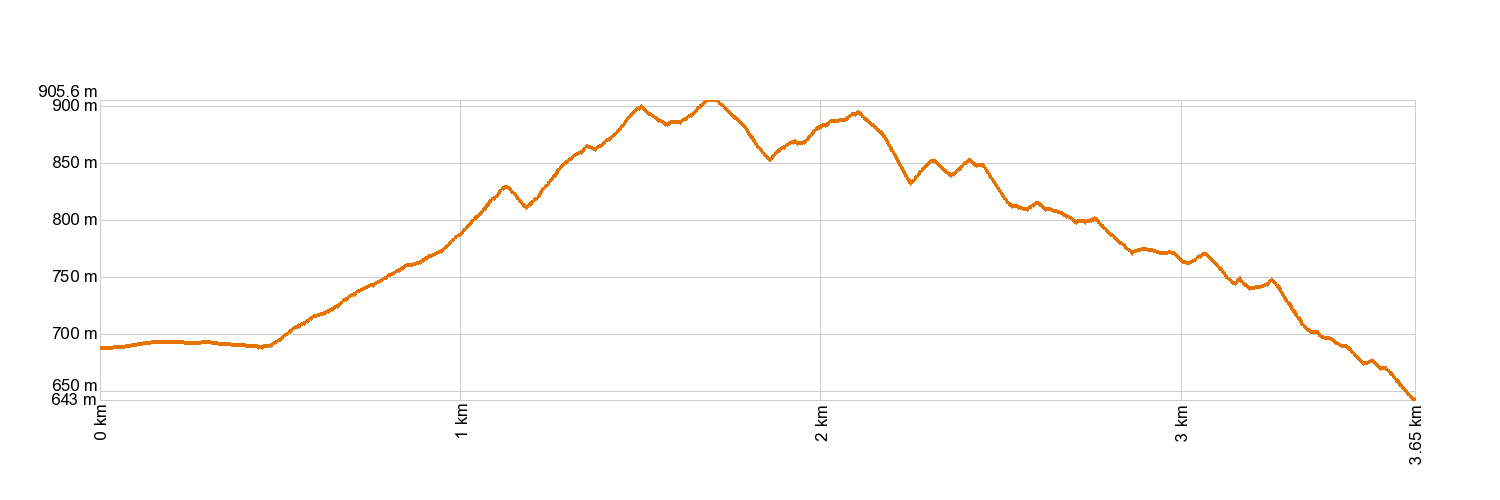
- Distance: 3.7 km (12.89 ft)
- Duration: 2 hours
- Highest altitude: 912 m (12.89 ft)
- Lowest altitude: 657 m (12.89 ft)
- Elevation gain: 276.50 m (12.89 ft)
- Elevation loss: 309.05 m (12.89 ft)
- Links to other trails:
- Protected Nature Areas:
- Authorisation required: No
- Competent authority: Tenerife Council
- About the competent authority: PR-TF 59 Las Portelas - Masca
Trail description
The trail begins in La Portela Baja (in the municipality of Buenavista del Norte) and heads southwest along Calle De Fuera. After about 200 yards of paved road, the trail turns into a track and then a footpath. You will cross the Las Lubes ravine and head up along the western side of it. The trail crosses the track of Mazapé and, when it comes to the road, you will need to cross it very carefully. Walk on up the slopes of “Martín Bay” to La Cumbre (La Cancela). Carry on past the headwaters of the Juan López ravine to the Cruz de Hilda lookout point, then prepare for a steep descent to El Turrón, one of the hamlets in Masca.
Hypsometry
For your own safety, don't forget to check the condition of the trail.
The competent authority will be responsible for informing you if the trail is not recommendable in the wake of adverse weather conditions, as well as if the trail or part of it is closed, etc.
![]() In case of an emergency, call 112.
In case of an emergency, call 112.
Download FRESS 112, available for iOS and Android
Weather Today
Maximum: 23º
Minimum: 17º
Buenavista del Norte. Mostly clear skies, but more cloud cover will develop on Friday morning. In the afternoon, cloudy with drizzle. At night, mostly cloudy skies. Mild temperature dropping.