PR-TF 43.1 San José de los Llanos - Chinyero Mountain
Technical information
- Start: San José de Los Llanos
- Finish: Chinyero Circular trail
- Approval status: In progress
- Degree of difficulty: Low
- Type of trail: Linear
- Distance: 4.3 km (12.89 ft)
- Duration: 1 hour 30 mins.
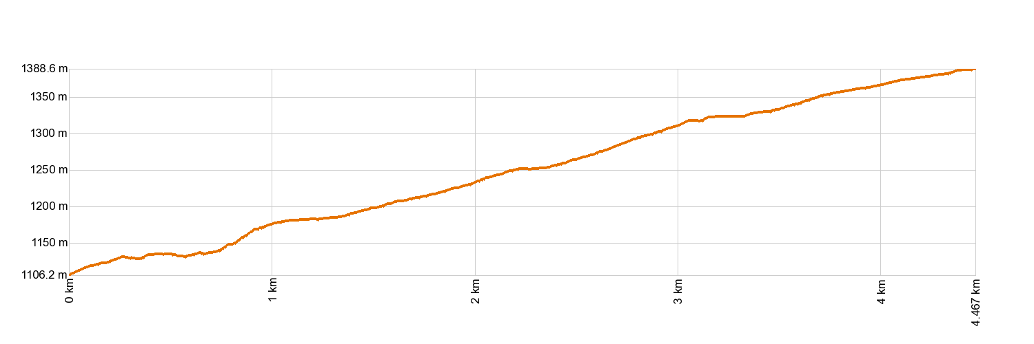
- Highest altitude: 1,394 m (12.89 ft)
- Lowest altitude: 1,106 m (12.89 ft)
- Elevation gain: 306.13 m (12.89 ft)
- Elevation loss: 15.66 m (12.89 ft)
- Links to other trails:
- Protected Nature Areas:
- Authorisation required: No
- Competent authority: Tenerife Council
- About the competent authority: PR-TF 43.1 San José de Los Llanos - Chinyero Mountain
Trail description
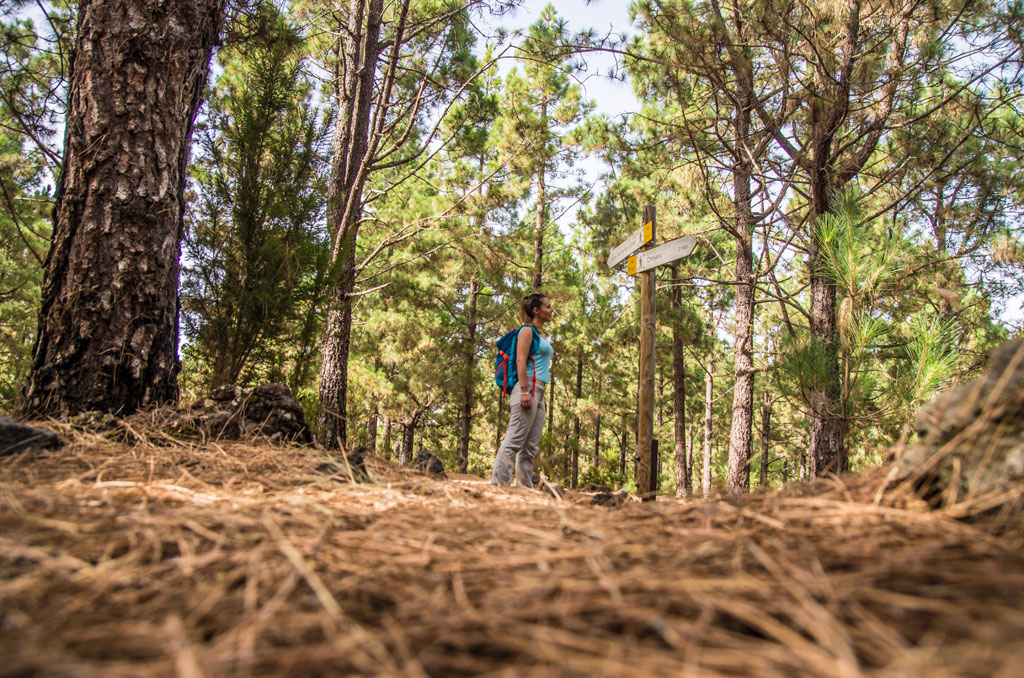
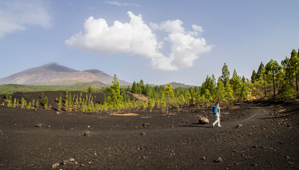
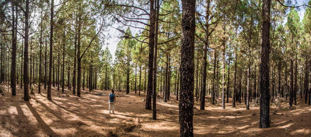
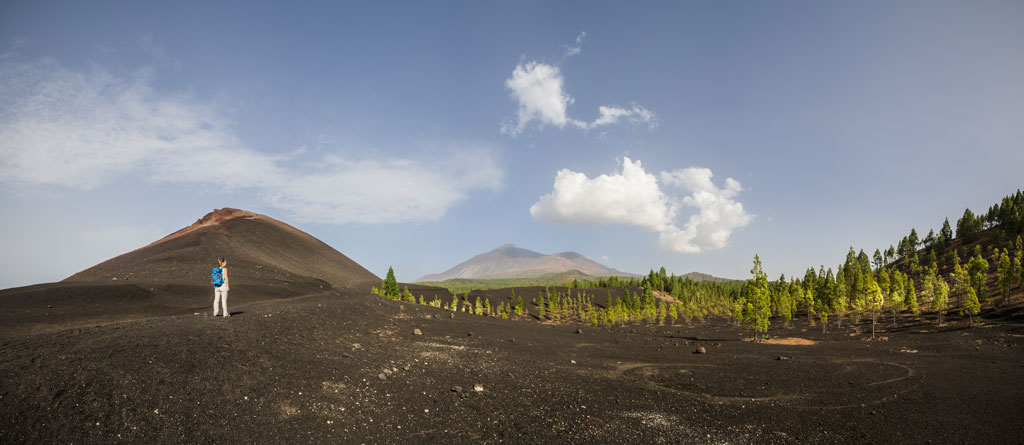
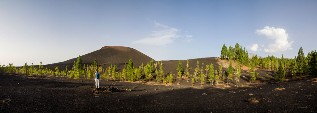
Starting at Plaza San José de Los Llanos (in the municipality of El Tanque), follow Calle Brisas del Teide up into the pine forest. You will soon pass the mountains of La Quebrada and El Blanco, before later reaching the mountains of La Atalaya and El Volcán de Trevejos. You will then cross the track and water channel of Vergara before heading on towards the foot of Pico de Las Flores. The trail will guide you onwards until you reach the PR-TF 43 Garachico - Chinyero Mountain track.
Hypsometry
For your own safety, don't forget to check the condition of the trail.
The competent authority will be responsible for informing you if the trail is not recommendable in the wake of adverse weather conditions, as well as if the trail or part of it is closed, etc.
![]() In case of an emergency, call 112.
In case of an emergency, call 112.
Download FRESS 112, available for iOS and Android
Weather Today
Maximum: 21º
Minimum: 14º
El Tanque. It will be foggy on Saturday morning. In the afternoon there will be light, fine, continuous rain-fall. At night mist is expected. Temperatures will remain unchanged.