SL-TF 296.1 El Rincón Ravine
Technical information
- Start: Araya
- Finish: Las Cuevecitas
- Approval status: Approved
- Degree of difficulty: Low
- Type of trail: Linear
- Distance: 1.4 km (12.89 ft)
- Duration: 45 mins.
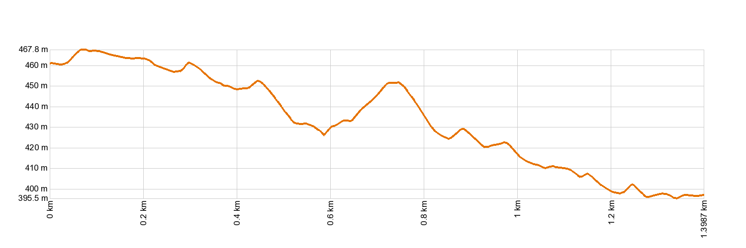
- Highest altitude: 470 m (12.89 ft)
- Lowest altitude: 392 m (12.89 ft)
- Elevation gain: 65.8 m (12.89 ft)
- Elevation loss: 134 m (12.89 ft)
- Links to other trails:
- Authorisation required: No
Trail description
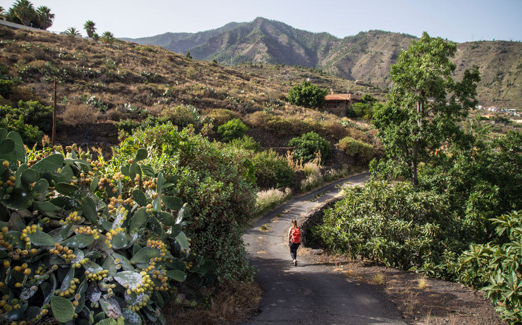
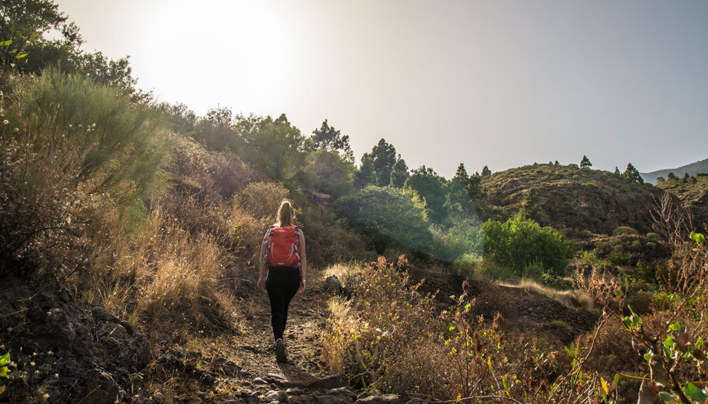
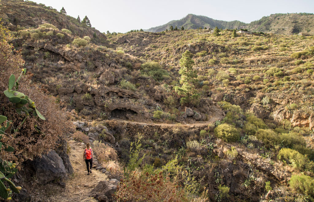
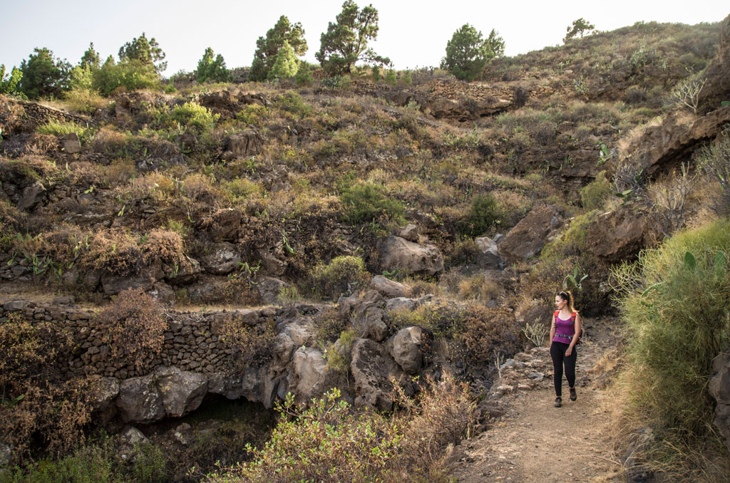
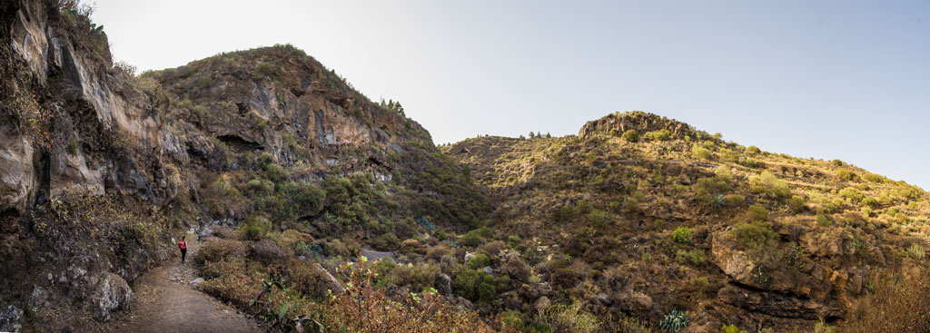
A leisurely walk, barely 1.4 km (0.87 miles) long, that takes you along the El Rincón Ravine path, linking the area of Las Cuevecitas to the rest of the routes in the Local Trail Network. Starting at Plaza de las Cuevecitas, you will reach Calle La Hoya to take the path towards the El Rincón Ravine, the first stretch of which follows a narrow and winding footpath that meanders around the natural obstacles along its way. Once you reach the ravine, the trail heads upwards cutting across several country tracks, including one that joins the El Rincón gulley to Araya. The trail once again takes the shape of a narrow footpath with compact earth underfoot and the odd stretch of stone paving, running parallel to the water channel. The last stretch crosses an area of abandoned farm terraces that bear witness to the significance of farming in the region in the 20th century. At the end of the walk, where different paths meet, you may wish to take the Los Brezas Circular trail or the La Mesa trail.
Hypsometry
For your own safety, don't forget to check the condition of the trail.
The competent authority will be responsible for informing you if the trail is not recommendable in the wake of adverse weather conditions, as well as if the trail or part of it is closed, etc.
- Competent authority: Candelaria Town Council
- About the competent authority: SL-TF 296.1 El Rincón Ravine
![]() In case of an emergency, call 112.
In case of an emergency, call 112.
Download FRESS 112, available for iOS and Android
Weather Today
Maximum: 26º
Minimum: 19º
Candelaria. It will be good weather on Wednesday morning. As the hours pass by, sunny skies. Temperatures will remain unchanged.