PR-TF 53 Los Silos - Cuevas Negras - Erjos
Technical information
- Start: Erjos
- Finish: Los Silos
- Approval status: Approved
- Degree of difficulty: Intermediate
- Type of trail: Linear
- Distance: 5.7 km (12.89 ft)
- Duration: 3 hours
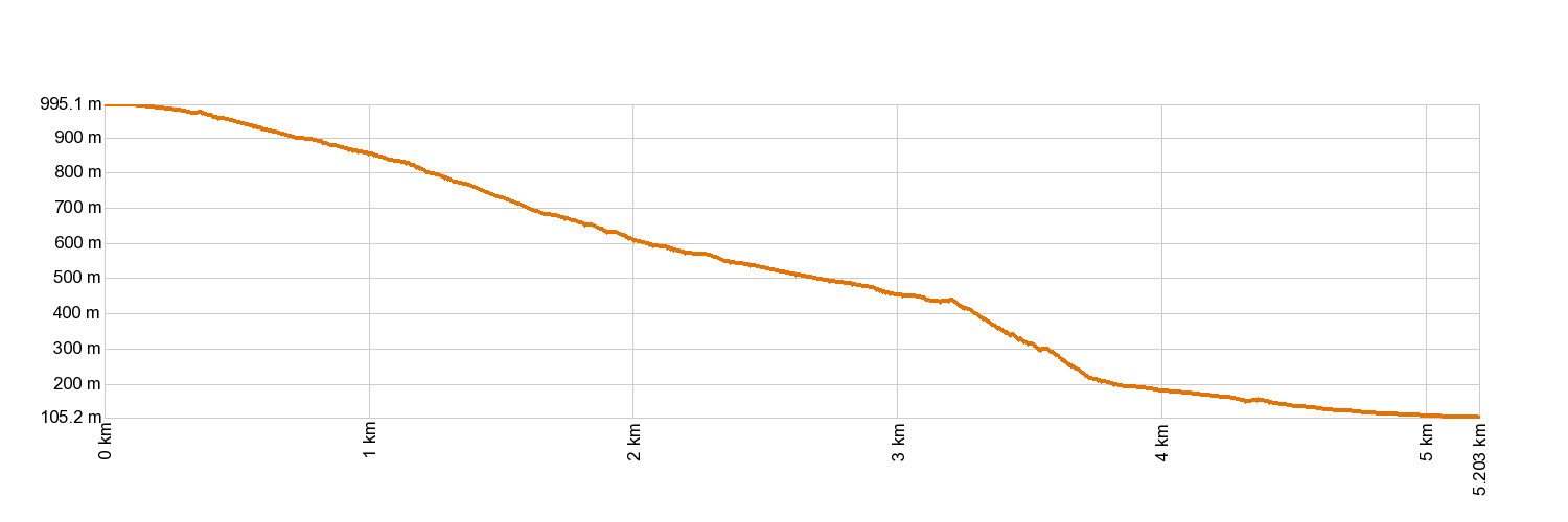
- Highest altitude: 1,000 m (12.89 ft)
- Lowest altitude: 105 m (12.89 ft)
- Elevation gain: 48.87 m (12.89 ft)
- Elevation loss: 940.06 m (12.89 ft)
- Links to other trails:
- PR-TF 51 San José de Los Llanos - Punta de Teno. Stretch: San José de Los Llanos - Baracán Lookout Point
- PR-TF 52 Erjos - Las Portelas (Monte del Agua)
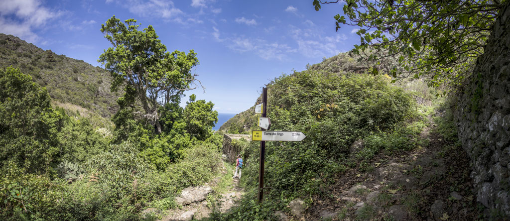
- PR-TF 53.1 Cuevas Negras - Tierra del Trigo
- PR-TF 54 Los Silos - Las Moradas - Monte del Agua
- PR-TF 55 Los Silos - Talavera - El Palmar
- Protected Nature Areas:
- Authorisation required: No
- Competent authority: Tenerife Council
- About the competent authority: PR-TF 53 Los Silos - Cuevas Negras - Erjos
Trail description
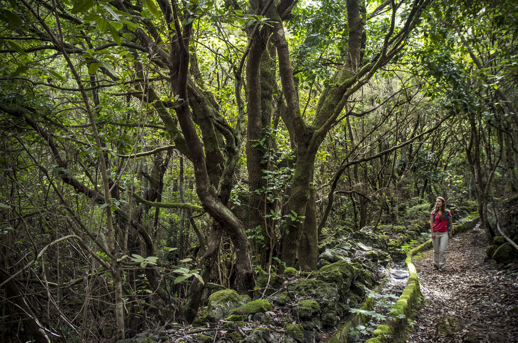
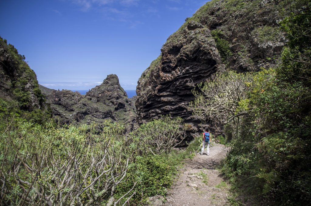
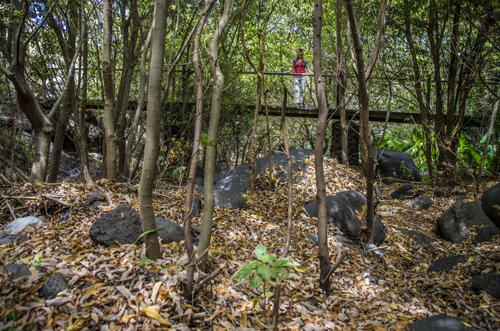
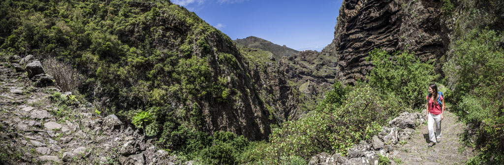
The trail starts in Erjos (Municipality of Los Silos). Cross the TF-82 road to Calle Las Cruces. Follow that street north and take the path there until you leave the last houses behind you. The path borders the ravine and after 3 km (1.8 miles) you will come to Cuevas Negras, where the path crosses the PR TF 53.1 trail. The trail carries on almost straight along the bottom of the El Salto ravine and you will reach Los Silos along Calle Susana.
Hypsometry
For your own safety, don't forget to check the condition of the trail.
The competent authority will be responsible for informing you if the trail is not recommendable in the wake of adverse weather conditions, as well as if the trail or part of it is closed, etc.
![]() In case of an emergency, call 112.
In case of an emergency, call 112.
Download FRESS 112, available for iOS and Android
Weather Today
Maximum: 24º
Minimum: 18º
Los Silos. The weather will be fine on Wednesday morning. As the hours pass by there will be not a cloud in the sky. Temperatures will remain unchanged.