31. Cumbres de Ucanca
Technical information
- Start: Cañada del Capricho
- Finish: Sombrero de Chasna
- Approval status: Not officially approved
- Degree of difficulty: High
- Type of trail: Linear
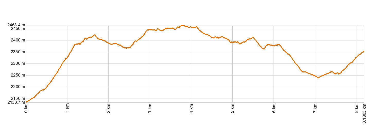
- Distance: 8.1 km (12.89 ft)
- Duration: 3 hours 30 mins.
- Highest altitude: 2,484 m (12.89 ft)
- Lowest altitude: 2,136 m (12.89 ft)
- Elevation gain: 726 m (12.89 ft)
- Elevation loss: 510 m (12.89 ft)
- Links to other trails:
- Protected Nature Areas:
- Authorisation required: No
Trail description
This entire trail is a lookout point, affording broad and breathtaking views of the inner side of La Caldera de Las Cañadas and of Tenerife's southern slopes. El Teide and Pico Viejo are two prominent sights on that picture postcard, as is the short tongue of lava known as Sombrero de Chasna. The trail begins in the area known as El Capricho from Siete Cañadas Trail 4, journeying up an old and very windy pathway to La Degollada de Ucanca, with a gain of nearly 300 m (985 ft). It then leads you across the peaks of Cumbres de Ucanca before descending to the edge of Teide National Park. You will be guided past Sombrero de Chasna and on to the ridge of Lomo del Asiento, also known as Los Pegueros, where the greenery changes to reveal old twisted Canarian pine trees. The trail can either take you down to Vilaflor or onto a trail that branches off to the left, reaching the Las Lajas Recreation Area.
Hypsometry
For your own safety, don't forget to check the condition of the trail.
The competent authority will be responsible for informing you if the trail is not recommendable in the wake of adverse weather conditions, as well as if the trail or part of it is closed, etc.
- Competent authority: Teide National Park
- About the competent authority: 31. Cumbres de Ucanca
![]() In case of an emergency, call 112.
In case of an emergency, call 112.
Download FRESS 112, available for iOS and Android
Weather Today
Maximum: 23º
Minimum: 20º
Orotava (La). The weather will be fine all Tuesday long. Mild temperature raising.