PR-TF 43 Garachico - Chinyero Mountain
Technical information
- Start: Garachico
- Finish: Chinyero Circular trail
- Approval status: In progress
- Degree of difficulty: High
- Type of trail: Linear
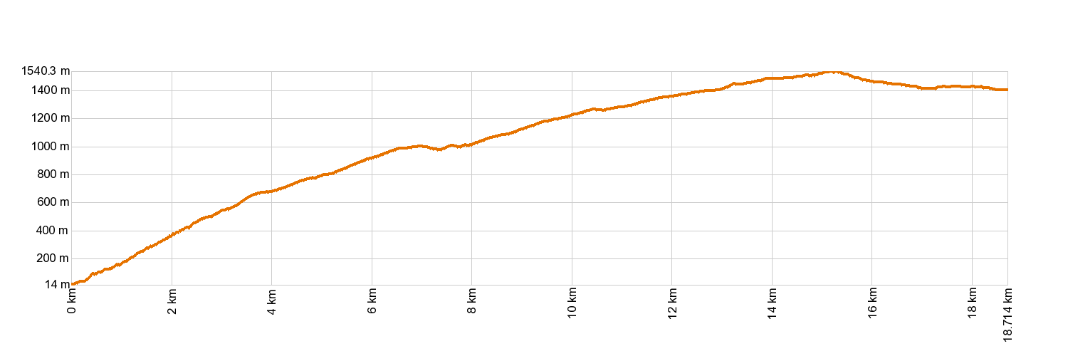
- Distance: 17.7 km (12.89 ft)
- Duration: 7 hours
- Highest altitude: 1,521 m (12.89 ft)
- Lowest altitude: 46 m (12.89 ft)
- Elevation gain: 1,680 m (12.89 ft)
- Elevation loss: 287.52 m (12.89 ft)
- Links to other trails:
- Protected Nature Areas:
- Authorisation required: No
- Competent authority: Tenerife Council
- About the competent authority: PR-TF 43 Garachico-Chinyero Mountain
Trail description
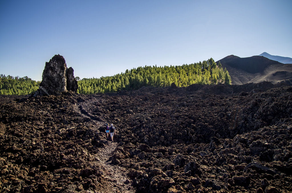
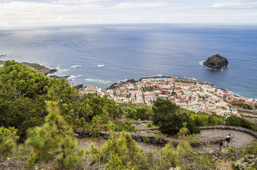
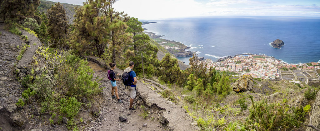
From Garachico, the trail follows the El Lance pathway up to San Juan del Reparo, across tongues of solid lava that create a fascinating landscape. You will reach the village of La Montañeta, where the trail takes you towards the Arenas Negras recreation area and La Montaña de las Flores. Here begins a circular trail around the Chinyero volcano, surrounded by volcanic lapilli, past several centuries-old pine trees, such as the Cha Lorenza pine tree, where a lookout point treats you to a breathtaking view over the south face of the volcano. You will also see several mountains such as La Corredera, Los Poleos and La Cruz along the way, as well as enjoying great panoramic views of El Teide and Pico Viejo on clear days.
Hypsometry
For your own safety, don't forget to check the condition of the trail.
The competent authority will be responsible for informing you if the trail is not recommendable in the wake of adverse weather conditions, as well as if the trail or part of it is closed, etc.
![]() In case of an emergency, call 112.
In case of an emergency, call 112.
Download FRESS 112, available for iOS and Android
Weather Today
Maximum: 22º
Minimum: 16º
Garachico. It will be foggy on Saturday morning. In the afternoon there will be light, fine, continuous rain-fall. At night there will be some mist. Temperatures will remain unchanged.