PR-TF 70 Guía de Isora - Tágara - Boca Tauce
Technical information
WARNING! Trail closed. Walking here is not permitted.
- Start: Guía de Isora
- Finish: Boca Tauce
- Approval status: In progress
- Degree of difficulty: High
- Type of trail: Linear
- Distance: 17.5 km (10.9 miles); open stretch of 6.5 km (4 miles)
- Duration: 8 hours 30 mins. (3 hours on the open stretch)
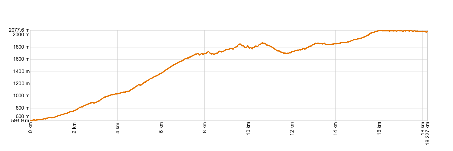
- Highest altitude: 2,083 m (12.89 ft)
- Lowest altitude: 576 m (12.89 ft)
- Elevation gain: 2,039.67 m (12.89 ft)
- Elevation loss: 578.97 m (12.89 ft)
- Links to other trails:
- PR-TF 70.1 Aripe
- PR-TF 70.2 Chirche
- Protected Nature Areas:
- Authorisation required: No
- Competent authority: Tenerife Council
- About the competent authority: PR-TF 70 Guía de Isora - Tágara - Boca Tauce
Trail description
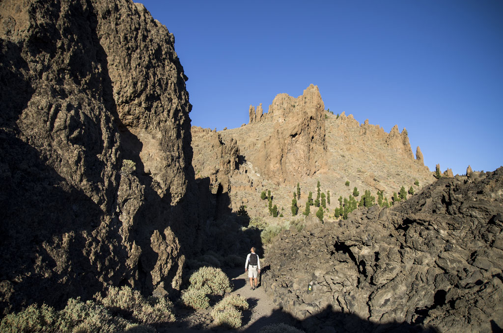
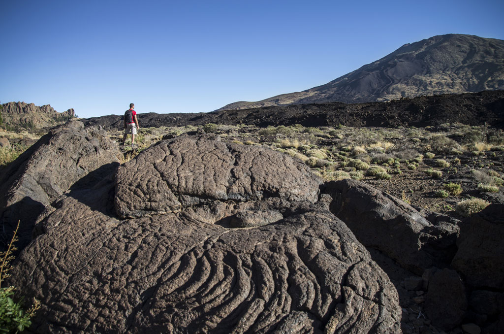
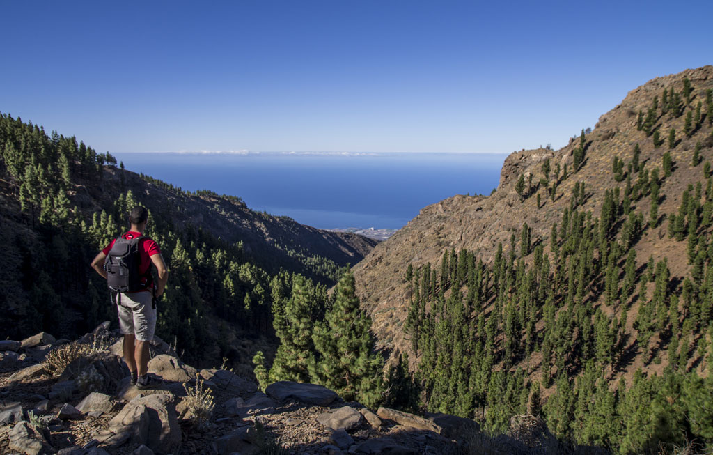
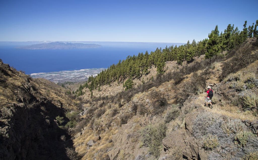
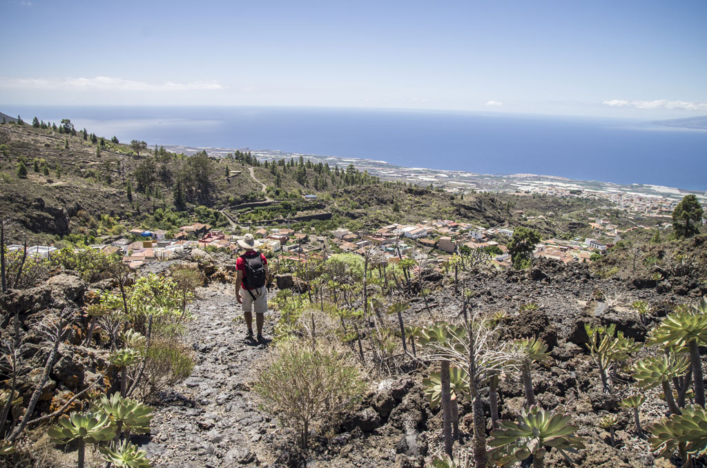
Starting from the church in Guía de Isora, the trail takes you up through the streets of this lovely town and onto the path. After about 2 km (1.2 miles), you will see the turn-off towards the village of Aripe (PR-TF 70.1). Follow the PR-TF 70 Guía de Isora - Tágara - Boca Tauce trail upwards, past some old tile ovens, fruit drying areas and threshing fields until you come to the village of Chirche (PR-TF 70.2). Veer left and you will reach the square of Chirche. From there, the trail takes you through vineyards and bush to La Era de Las Vistas. As you come out of the pine forest of Tágara, you will be rewarded with stunning views of the Niágara ravine, all the way to Boca de Chavao. You will then be walking at the foot of the mighty rock formations until you come to the end of the trail: Boca Tauce.
Hypsometry
For your own safety, don't forget to check the condition of the trail.
The competent authority will be responsible for informing you if the trail is not recommendable in the wake of adverse weather conditions, as well as if the trail or part of it is closed, etc.
![]() In case of an emergency, call 112.
In case of an emergency, call 112.
Download FRESS 112, available for iOS and Android
Weather Today
Maximum: 27º
Minimum: 15º
Guía de Isora. It will be good weather on Thursday morning. As the hours pass by there will be high cloud. Temperatures will remain unchanged.