PR-TF 86.3 La Sabinita - Tamadaya
Technical information
- Start: La Degollada
- Finish: Era de los Borges
- Approval status: In progress
- Degree of difficulty: Low
- Type of trail: Linear
- Distance: 3.1 km (12.89 ft)
- Duration: 1 hour 30 mins.
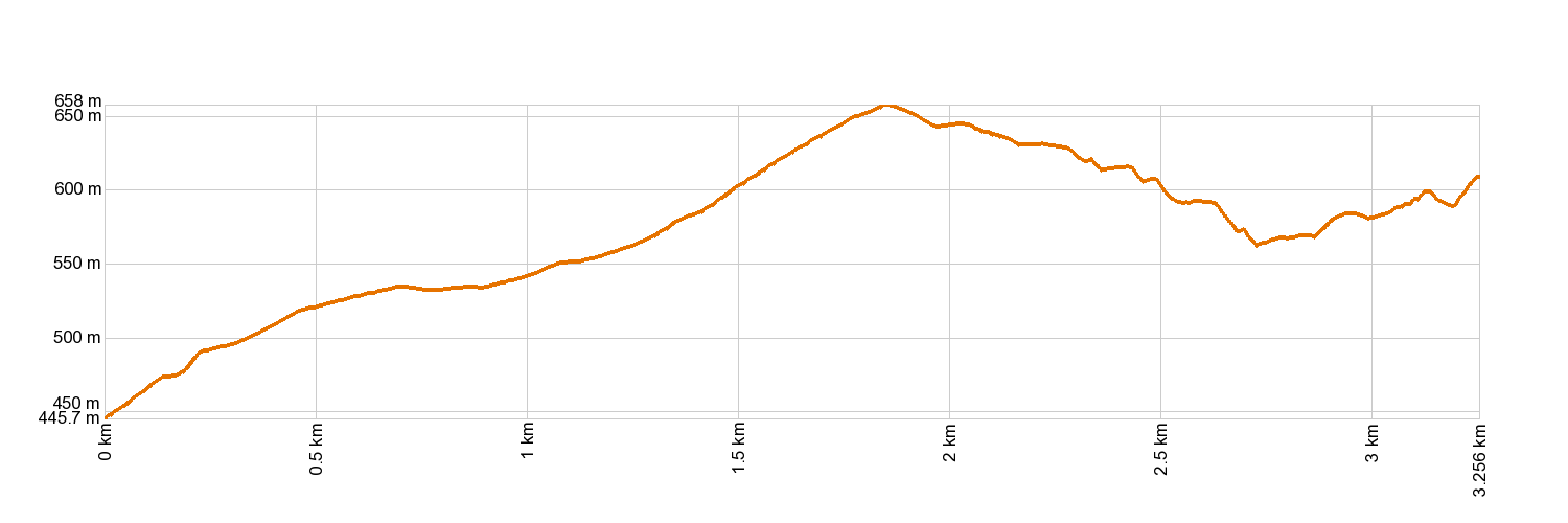
- Highest altitude: 665 m (12.89 ft)
- Lowest altitude: 455 m (12.89 ft)
- Elevation gain: 310.46 m (12.89 ft)
- Elevation loss: 144.09 m (12.89 ft)
- Links to other trails:
- Protected Nature Areas:
- Authorisation required: No
- Competent authority: Tenerife Council
- About the competent authority: PR-TF 86.3 La Sabinita - Tamadaya
Trail description
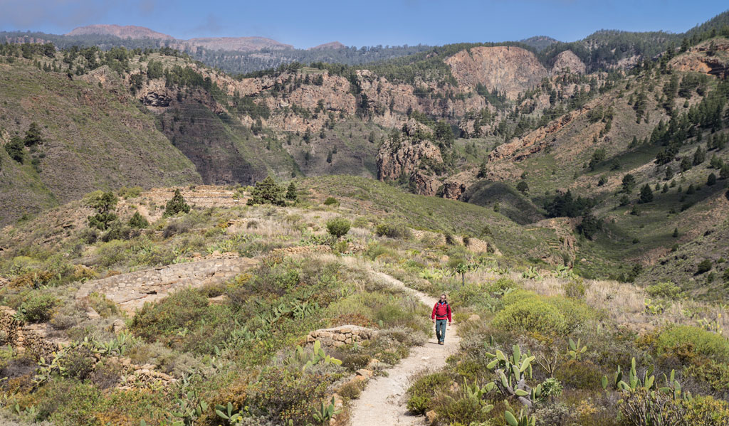
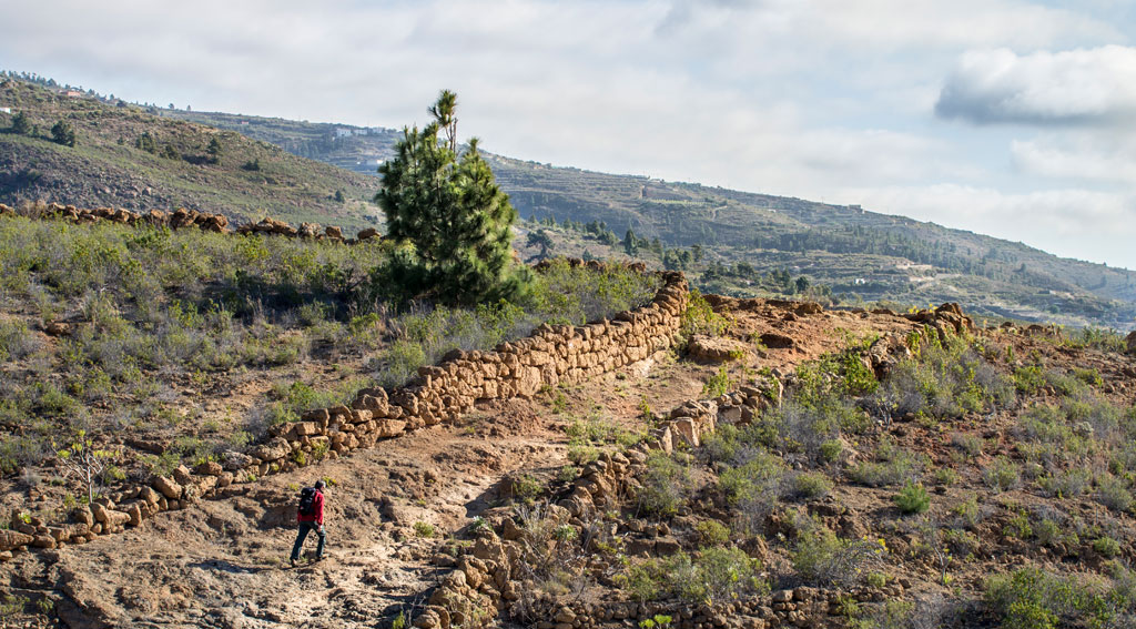
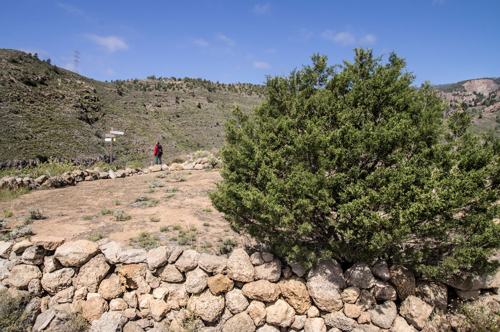
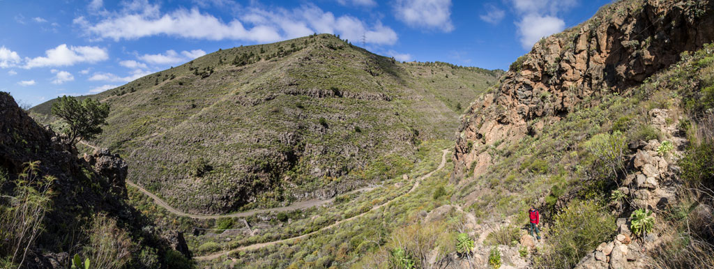
Starting in La Degollada and heading towards La Sabinita, take the upward path, which will soon lead you over an irrigation channel that was carved into the rock. The path then joins the paved road to La Sabinita. After taking you through the neighbourhood of La Sabinita, you will come to the Tamadaya ravine. Following several stretches of country tracks and old pathways, you will find yourself climbing up the ridge of Lomo de Tamadaya. Once at the top, by the threshing fields of Los Borges, you will come to the PR-TF 86.2 Arico Nuevo - El Contador Recreation Area trail.
Hypsometry
For your own safety, don't forget to check the condition of the trail.
The competent authority will be responsible for informing you if the trail is not recommendable in the wake of adverse weather conditions, as well as if the trail or part of it is closed, etc.
![]() In case of an emergency, call 112.
In case of an emergency, call 112.
Download FRESS 112, available for iOS and Android
Weather Today
Maximum: 22º
Minimum: 14º
Arico. Mostly clear skies, but more cloud cover will develop on Friday morning. In the afternoon, cloudy with drizzle. At night, mostly cloudy skies. Temperatures will remain unchanged.