Route 4
Buenavista - Punta del Hidalgo
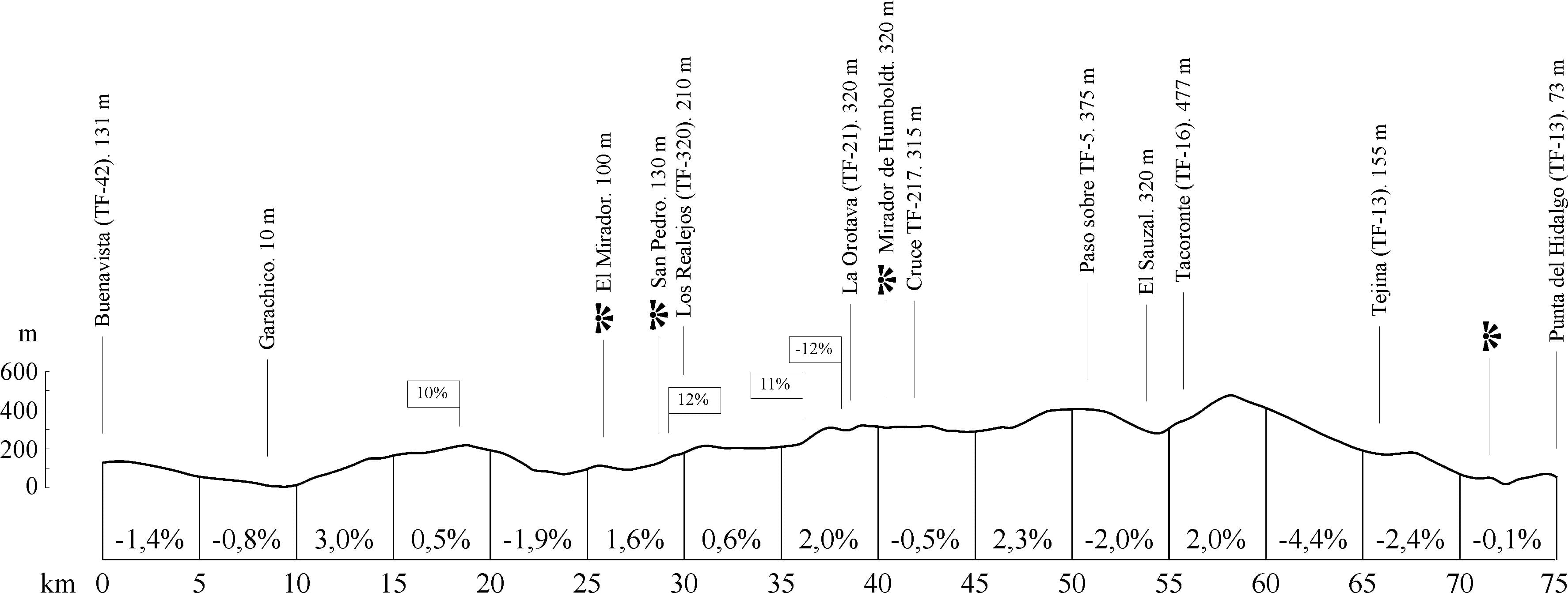
Technical information
- Start: Buenavista. TF-42.
- Finish: Punta del Hidalgo. TF-13.
- Distance: 75 km (46.6 miles).
- Cumulative ascent: 1,786 m (5,859 ft).
- Average gradient: 3.9%.
- Maximum altitude: 447 m (1,466 ft).
- Average speed: 22 kph (12.42 mph).
- Estimated duration: 3 hours 25 mins.
- Difficulty level: Intermediate.
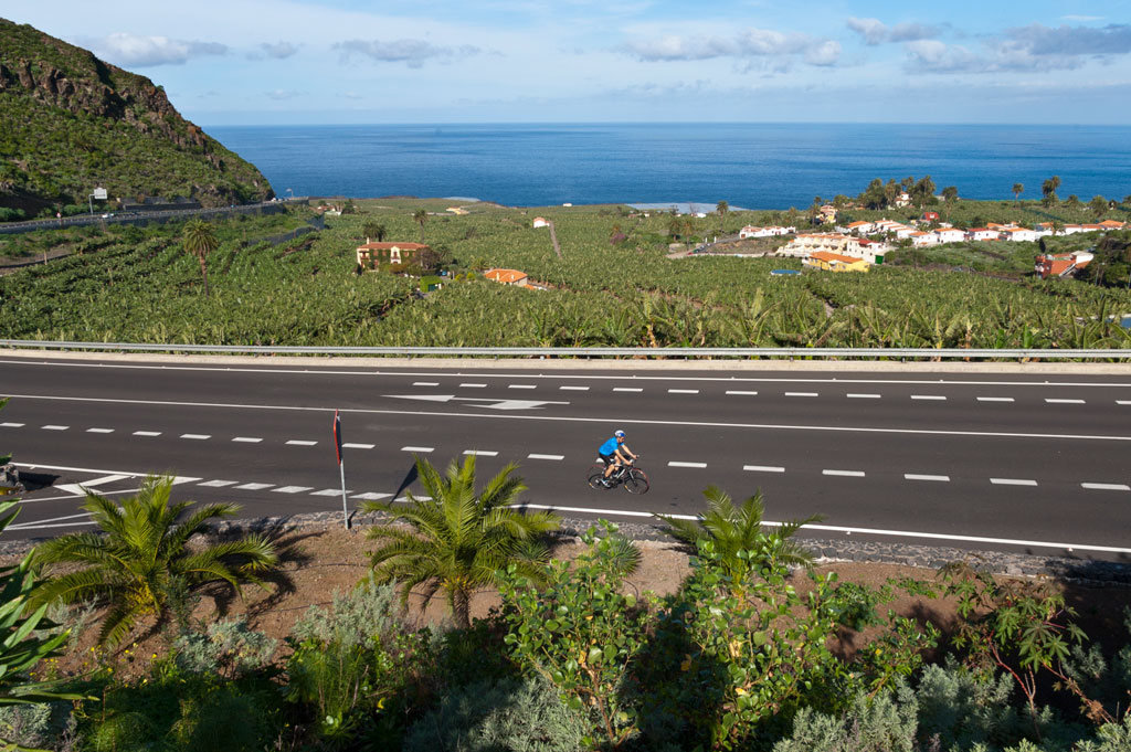
The aim of this route is to cross the whole of Tenerife from one corner to another. The route follows the north coast along generally flat terrain with relatively little cumulative ascent. It's an accessible route where you can take in a variety of landscapes. The total distance is 75 km (46.6 miles).
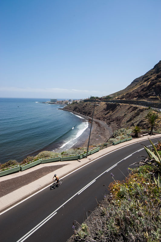
Your journey begins on the north-west tip of Tenerife, in the town of Buenavista del Norte, in the Isla Baja region. You will set off on the TF-42 road, including stretches which slope gently downhill. You will pass to the south of the town of Los Silos and continue your journey surrounded by farmland, until you come to Garachico at km 8.5 (mile 5.3). This part of the route takes you along the coast before an uphill stretch begins. When you reach the area of El Guincho, you will have to avoid the tunnel as cyclists are not allowed through it. To do so, take the diversion to the right along the road signposted "El Guincho" before returning to the TF-42.
That same road will take you past the towns of Icod de los Vinos and San Juan de la Rambla on a constantly undulating stretch with an average gradient of less than 4%. At km 26 (mile 16), you will come to the area of "El Mirador" (a lookout point located alongside the "El Mirador" petrol station), where you can stop to take in the breathtaking sea views. You can do the same from the San Pedro lookout point at km 28.4 (mile 17.5).
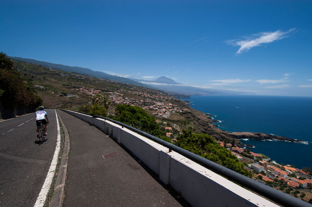
As you come to the town of Los Realejos, the TF-42 turns into the TF-5 motorway. To avoid this road, bear left to take the TF-320 at km 30 (mile 18.6), once you come to the roundabout at the entrance to Los Realejos. Further ahead, the road will cross the motorway as it takes you to La Orotava, which you will access from Calle Leonor Monteverde. After a short stretch that crosses the town centre, the route continues along the TF-21. The Humboldt lookout point awaits you at km 40.7 (mile 25.3), affording spectacular views over the La Orotava valley. At km 41.6 (mile 25.8), the TF-21 comes to an end and your journey will continue along the TF-217 to La Matanza. Here, the road crosses a bridge over the TF-5 motorway. Once you reach the roundabout, you will descend just over a hundred metres and turn right to take the Las Breñas road (TF-1224). The name of that road will then change to Los Ángeles and will lead you to the village of El Sauzal at km 54 (mile 33.5), at an altitude of 320 m (1,050 ft). From this point on, you will come to a considerable slope with an average gradient of 7% until you reach the roundabout on the El Pris intersection, at an altitude of 477 m (1,565 ft). This is the highest point on the route. You will then have to take the TF-16 towards Valle de Guerra and Tejina, as signposted. The stretch that takes you to the town of Tejina is a descent with an average gradient of 5%.
After crossing the town from one end to the other, you will need to take the TF-13 at km 67 (mile 41.6) towards Bajamar. This road will take you to Punta del Hidalgo, where your journey ends. On arrival, you will have covered a total of 75 km (46.6 miles). Between Bajamar and Punta del Hidalgo, you will find a number of lookout points from where you can enjoy the beauty of the coastal landscape.
Hypsometry
Weather Today
Maximum: 24º
Minimum: 19º
Buenavista del Norte. There will be spells of heavy rain on Friday morning. In the afternoon, calm weather. At night clouds will alternate with clear skies. Temperatures will remain unchanged.