37. Cerrillar - Carnicería
Technical information
- Start: Lomo del Cerrillar
- Finish: Montaña de La Carnicería
- Approval status: Not officially approved
- Degree of difficulty: Low
- Type of trail: Linear
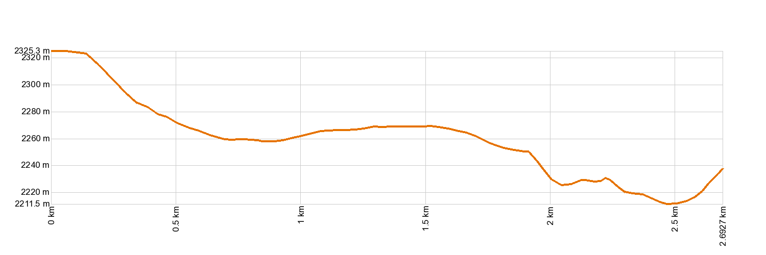
- Distance: 2.7 km (12.89 ft)
- Duration: 1 hour 30 mins.
- Highest altitude: 2,331 m (12.89 ft)
- Lowest altitude: 2,214 m (12.89 ft)
- Elevation gain: 56.7 m (12.89 ft)
- Elevation loss: 145 m (12.89 ft)
- Links to other trails:
- Protected Nature Areas:
- Authorisation required: No
Trail description
This linear trail links the trails of Arenas Negras and Volcán de Fasnia. You will start on the northeast part of the Arenas Negras trail, near Montaña del Cerrillar, journeying up the slopes of Montaña de la Punta de Maja and across the start of El Filo Trail 8. Your hike continues eastbound, perpendicular to that trail, to the mountain pass between Montaña de Enmedio and La Carnicería, where it ends on Volcán de Fasnia Trail 20. Along the way, you will glimpse the magnificent landscapes of the Valley of La Orotava between the volcanoes of the Caramujo area, unless the view is hidden beneath a sea of clouds. The trail allows hikers who are crossing the National Park to get from the El Portillo area to Izaña without taking the paved road, which makes for a more enriching experience across the peaks and brings you into closer contact with nature.
Hypsometry
For your own safety, don't forget to check the condition of the trail.
The competent authority will be responsible for informing you if the trail is not recommendable in the wake of adverse weather conditions, as well as if the trail or part of it is closed, etc.
- Competent authority: Teide National Park
- About the competent authority: 37. Cerrillar - Carnicería
![]() In case of an emergency, call 112.
In case of an emergency, call 112.
Download FRESS 112, available for iOS and Android
Weather Today
Maximum: 22º
Minimum: 14º
Orotava (La). It will be good weather on Friday morning. In the afternoon there will be some mist. At night the fog will cause reduced visibility. Mild temperature dropping.