
Santa Úrsula
Santa Úrsula possesses every charm that a municipality in this part of Tenerife typically has, enhanced by the green colour of its countryside and the blue sparkle of the sea. A swim in its bays, a walk through the surrounding nature or a stroll around the historic quarter are lovely ways for visitors to pass the time.
Santa Úrsula covers 22.59 km2 (8.7 sq miles) and is located in northern Tenerife. The story behind the origin of the municipality's name says that the mayor Alejo Pérez gave over some of his land to build a church in honour of Santa Úrsula, as his daughter was named Ursula. The municipality ranges all the way from the coast up to its highest point: Morra de Itote, 1,794 m (5885 ft) above sea level. Although the slopes on the rugged coastline are quite gentle, it gets steeper on the way up the hills to the peak. Santa Úrsula only has two small bays in the areas known as Santa Ana and Charco del Negro. Some of the municipality's protected areas are the Special Nature Reserve of Las Palomas and the Protected Landscapes of Las Lagunetas and Costa de Acentejo. The sea breeze and the blanket of cloud that forms around the mountainside bring the average annual temperature in Santa Úrsula down slightly to 19 ºC (66 ºF).
Historically, the municipal economy was based on traditional farming, but has now switched to the service sector. Nevertheless, farming is still important here and covers large expanses of land on the hillsides.
Routes around the municipality
An all encompassing walking route to discover all of the municipality's heritage would ideally start at the Church of Santa Úrsula and then head to the estate of Hacienda de San Clemente and visit its chapel. Visitors wishing to explore some of the municipality's natural resources will get a taste along the Barranco Hondo trail down to the beach of El Canto.
We answer to your frequently asked questions
Everything you need to know about Saint Ursula
Where is Santa Úrsula?
Santa Úrsula is a municipality located in the north of the island of Tenerife, in the Acentejo region, between La Orotava to the west, La Victoria de Acentejo to the east, and the Atlantic Ocean to the north. Its territory extends from the coastline, with its impressive cliffs, through agricultural mid-altitude areas full of vineyards and further up to the ridge summit, where the municipality’s highest point reaches 1,794 metres above sea level at Morra de Itote. The municipality covers 22.59 km² and combines a highly diverse landscape, from coastal coves to laurel forests, passing through the vineyards that characterise this part of northern Tenerife.
How to get to Santa Úrsula?
Santa Úrsula has a very accessible location thanks to the northern Tenerife motorway. By car: the main access route is via the TF-5 motorway, taking exit 29 towards La Quinta residential area or the town centre:
- From Santa Cruz de Tenerife: around 25–30 minutes.
- From Puerto de la Cruz: only 10–15 minutes, as Santa Úrsula is located directly between both towns.
- From Tenerife North Airport: around 15–20 minutes.
- From Tenerife South Airport: approximately 1 hour.
By public transport, TITSA guagua (bus) lines connecting Santa Cruz de Tenerife with Puerto de la Cruz pass through the municipality, specifically lines 102 and 30, with stops on the main road from where the town centre and La Quinta can be reached on foot in a few minutes.
What to see in Santa Úrsula?
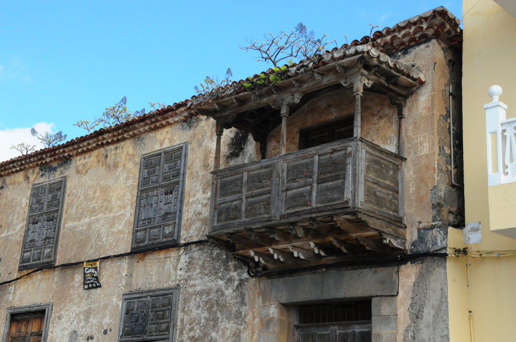
Santa Úrsula offers a wide range of places of interest, from historical monuments to natural spaces and distinctive corners. Among the most outstanding places to see in Santa Úrsula are:
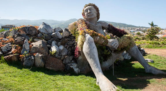
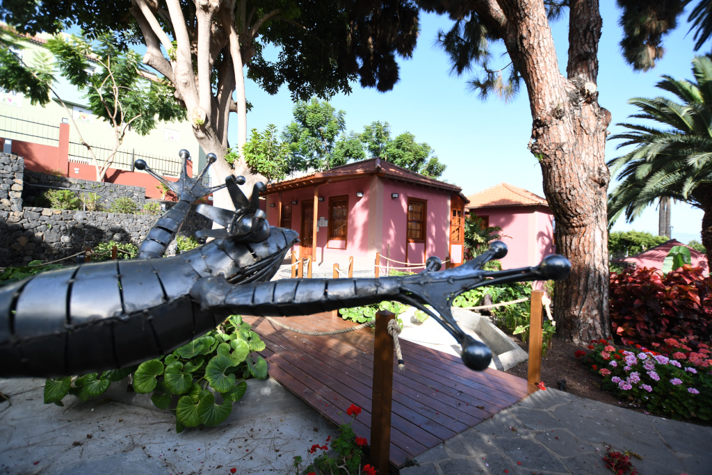
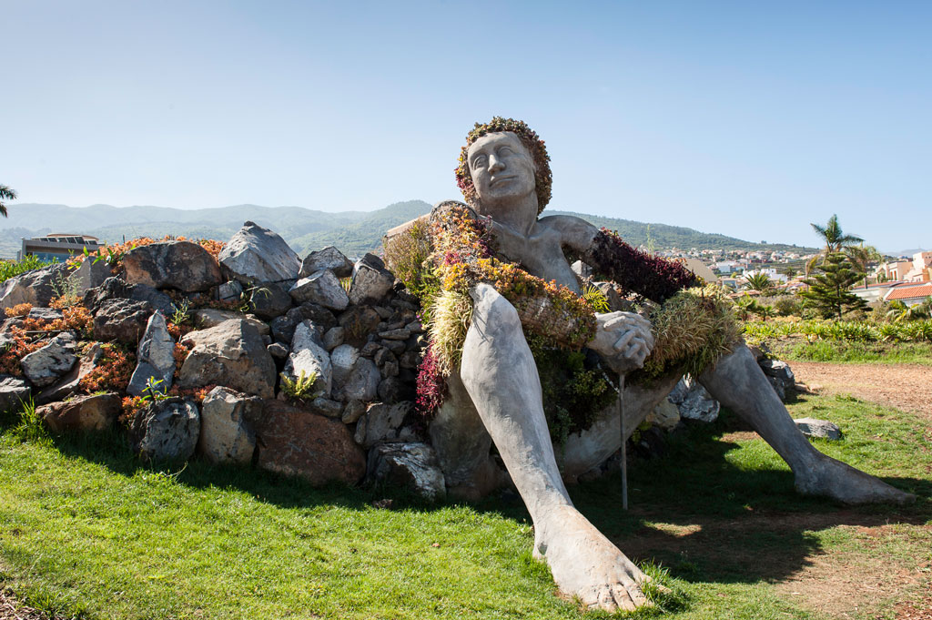
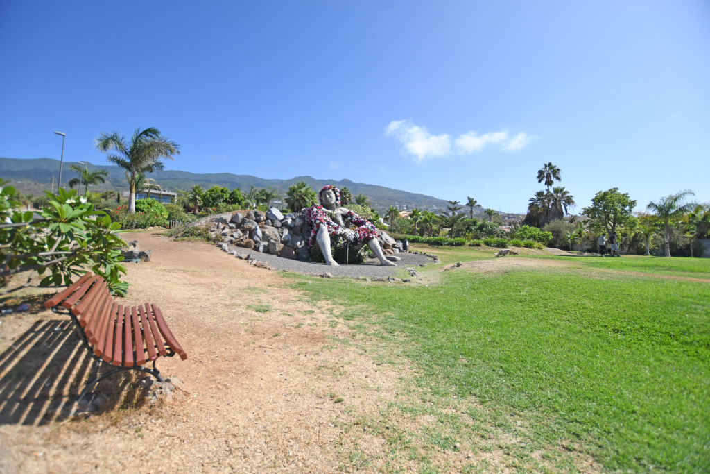
- La Giganta – Jardín Social de La Quinta, a 4-metre-high sculpture of a female figure integrated into the landscape, which has become the municipality’s most recognisable visual icon.
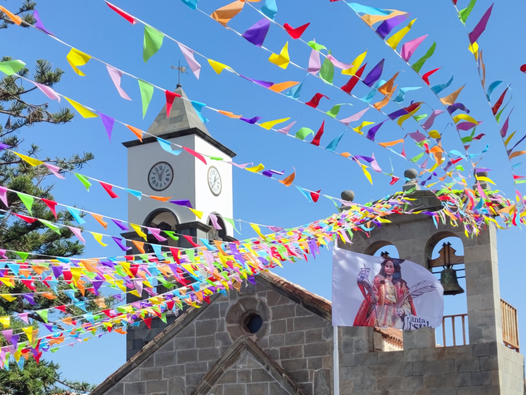
- Parish Church of Santa Úrsula, Virgin and Martyr, founded in 1587 and listed as a Site of Cultural Interest, with a remarkable interior featuring carvings and works of art.
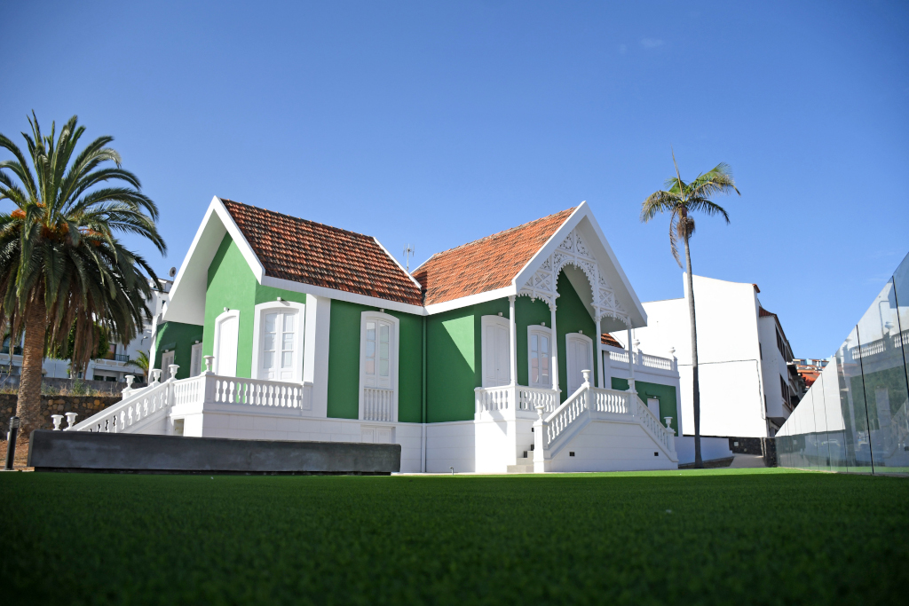
- Casa de la Portuguesa or Casa Verde, a late 19th-century British colonial-style building, declared a Site of Cultural Interest since 2007, one of the few examples of this type on the island.
- Casa de la Vera or Casa del Capitán, built in 1860, with a distinctive decorated sgraffito façade, also declared a Site of Cultural Interest.
- Casona de San Luis and Hacienda de San Clemente, examples of Canarian stately architecture linked to the municipality’s agricultural history.
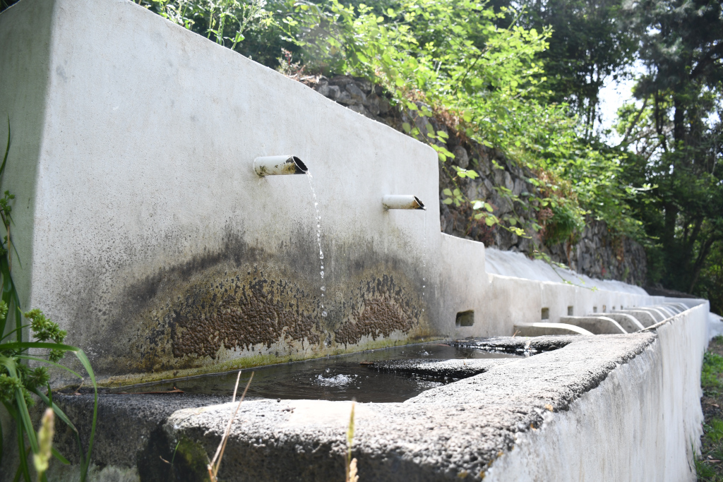
- Los Lavaderos de los Sauces, located in Barranco de los Sauces, an ethnographic space recalling the daily life of rural communities in northern Tenerife.
- La Quinta Bunker (Batería Quinta Roja), a World War II military installation with spectacular views over the Acentejo Coast.
- La Quinta Viewpoint, one of the most beautiful panoramic points in the north of the island, with views of the Acentejo cliffs and the Atlantic Ocean.
What is the Santa Úrsula Bunker?
The Santa Úrsula Bunker, also known as Batería Quinta Roja or La Quinta Bunker, is one of the most unique military constructions that can be visited in Tenerife. It was built between 1941 and 1942 under the dictatorship of Francisco Franco, as part of a defensive system designed to protect the northern coastline of Tenerife — specifically the Puerto de la Cruz area — from a possible Allied invasion during the Second World War. Access is via La Quinta residential area, taking exit 29 from the TF-5 motorway towards Puerto de la Cruz. Entry is completely free, although the path runs along a cliff approximately 170 metres high, so suitable footwear is recommended and it is not suitable for people with vertigo. The bunker is currently abandoned, but its panoramic views and historical value make it a very interesting visit for lovers of history and landscapes.
What to do in Santa Úrsula?
Santa Úrsula is a very active municipality in gastronomy, nature and culture, offering multiple options for a complete visit.
- Walk through the historic centre and discover its stately houses, hermitages and squares, following the urban routes proposed by the Town Hall.
- Visit the Social Garden and take the essential photo next to La Giganta, the municipality’s most photogenic symbol.
- Explore La Quinta Bunker and enjoy panoramic views of the Acentejo Coast from La Quinta Viewpoint.
- Explore the Special Nature Reserve of Las Palomas and the Protected Landscapes of Las Lagunetas, Bosque de los Sanguinos and Barranco Hondo Trail, natural routes crossing highly scenic ravines and laurel forest.
- Discover the vineyards and wineries of the region, where young and fruity wines with strong character are produced, and visit one of the municipality’s guachinches to pair gastronomy with local wine.
- Go down to Santa Ana Cove and Charco del Negro to enjoy swimming in the municipality’s small sheltered coastal areas.
Which beaches and coves are in Santa Úrsula?
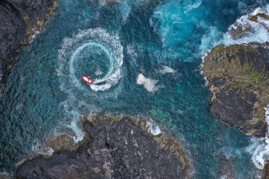
The coastline of Santa Úrsula is steep and made up of cliffs, meaning that the municipality has only two small natural coves, highly appreciated for their tranquillity and volcanic surroundings.
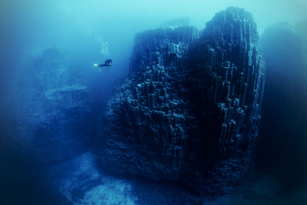
- Santa Ana Cove, a small inlet with crystal-clear waters and rocky seabed, mainly frequented by locals and divers. Access requires descending a steep path, which helps keep it uncrowded.
- Charco del Negro, another sheltered cove with calm waters, also accessible by path, ideal for enjoying the sea in a very authentic natural setting.
For those looking for larger beaches with services, the nearest options are El Bollullo Beach (La Orotava), El Socorro Beach (Los Realejos) or the beaches of Puerto de la Cruz, all just a few minutes away by car.
Where to eat in Santa Úrsula?
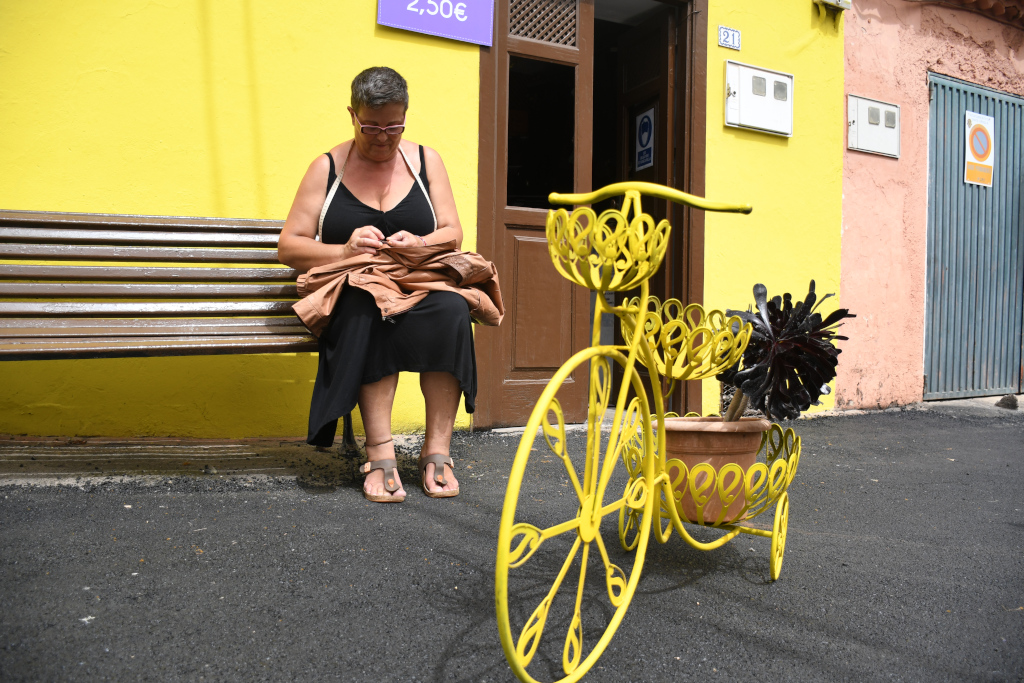
Santa Úrsula is one of the municipalities in northern Tenerife with the highest concentration of guachinches, typical Canarian establishments where homemade food is served together with locally produced wine from the region. The local gastronomy of Santa Úrsula is characterised by its link to wine tradition: the area’s young and fruity wines accompany typical dishes. Guachinches in Santa Úrsula usually open seasonally, coinciding with the new harvest months, and are mainly concentrated in the mid-altitude areas. Alongside guachinches, the municipality also has restaurants, taverns and traditional eateries where traditional Canarian gastronomy coexists with more modern and creative proposals, always paired with local wines.
What is the weather and temperature like in Santa Úrsula?
The climate of Santa Úrsula is mild and pleasant throughout the year, with characteristics typical of northern Tenerife: greener, cooler and more humid than the south, but with very mild winters and pleasant summers. The average annual temperature in the municipality’s coastal area is 19 °C. Because it faces north and is located in mid-altitude areas, Santa Úrsula may receive more cloud cover than southern municipalities, thanks to the effect of the trade winds and the sea of clouds, which favour the lush vegetation of its vineyards and forests.
What festivals are celebrated in Santa Úrsula?
Santa Úrsula has a festive calendar reflecting the municipality’s traditions and cultural life throughout the year. The most important festival is that of the municipality’s patron saint, Santa Úrsula, Virgin and Martyr, celebrated in October with religious ceremonies, processions, open-air dances, concerts and cultural activities in the town centre. It is the time of year when the municipality dresses up and brings together residents and visitors around its deepest-rooted traditions. In August, the San Luis Festivities are celebrated, especially known for the Remango dance, a traditional Canarian dance that is a hallmark of the municipality and has been passed down from generation to generation. Throughout the year, pilgrimages, music festivals and activities organised by the municipality’s many cultural associations also take place, making Santa Úrsula a place with an active cultural life strongly linked to its roots.

La catedral