29. Degollada del Cedro
Technical information
- Start: Cañada de Los Guancheros
- Finish: Ladera de Tigaiga
- Approval status: Not officially approved
- Degree of difficulty: Low
- Type of trail: Linear
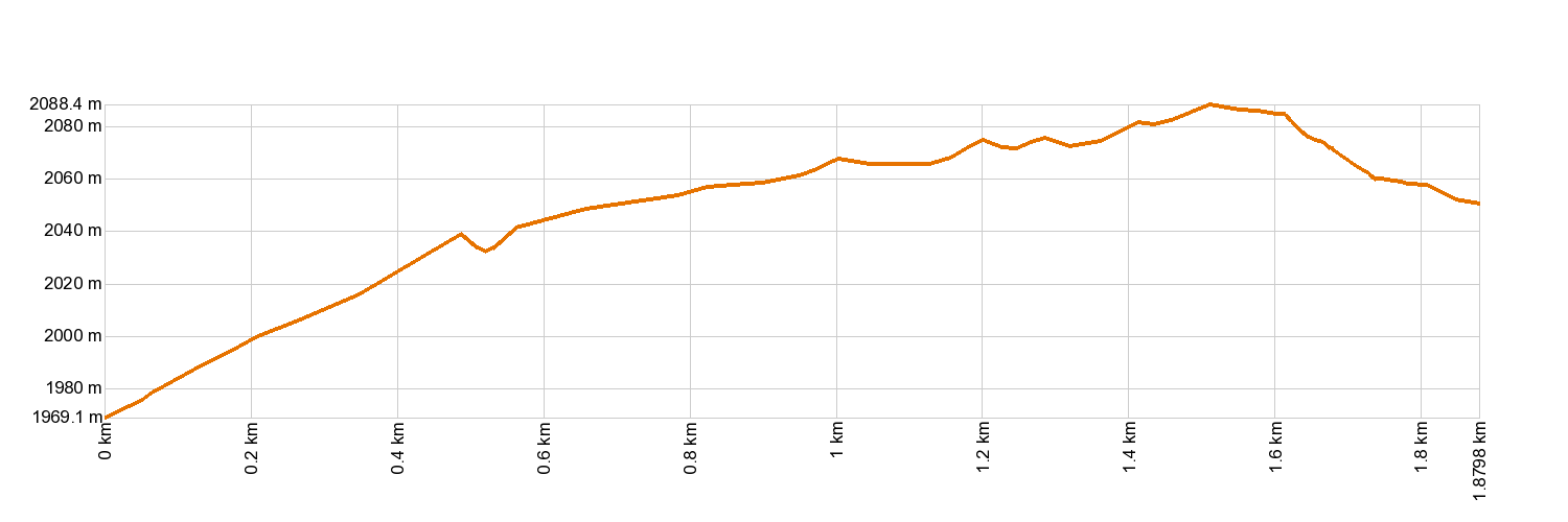
- Distance: 1.9 km (12.89 ft)
- Duration: 30 mins.
- Highest altitude: 2,086 m (12.89 ft)
- Lowest altitude: 1,973 m (12.89 ft)
- Elevation gain: 52.7 m (12.89 ft)
- Elevation loss: 117 m (12.89 ft)
- Links to other trails:
- Protected Nature Areas:
- Authorisation required: No
Trail description
The trail begins in La Cañada de los Guancheros, also known as Cañada de Los Rastrojos, at the foot of El Cabezón. It then follows a path up to Degollada del Cedro between the rocky walls of La Caldera de Las Cañadas known as El Cabezón and La Fortaleza. As the path fades into a forest track, it journeys down the Tigaiga mountainside to the edge of Teide National Park. Along the way, hikers will be rewarded with panoramic views of the Tigaiga slopes, La Fortaleza and the Valley of La Orotava, as well as peering into the inner side of La Caldera and, of course, the imposing Teide.
Hypsometry
For your own safety, don't forget to check the condition of the trail.
The competent authority will be responsible for informing you if the trail is not recommendable in the wake of adverse weather conditions, as well as if the trail or part of it is closed, etc.
- Competent authority: Teide National Park
- About the competent authority: 29. Degollada del Cedro
![]() In case of an emergency, call 112.
In case of an emergency, call 112.
Download FRESS 112, available for iOS and Android
Weather Today
Maximum: 38º
Minimum: 24º
Orotava (La). Sunny skies all Monday long. Temperatures will remain unchanged.