Pista de Las Hiedras Trail
Technical data
- Starting point: TF-143 El Batán road, Km 0.7
- Finish point: TF-145 Casas de El Río, Km 1
- Certification status:
- Degree of difficulty: Low
- Type of route: Linear
- Distance: 4.48 km
- Duration: 1 h 30 min
- Maximum height: 856 m
- Minimum height: 814 m
- Cumulative difference in altitude of ascent: 267 m
- Cumulative difference in altitude of descent: 280 m
- Connections with other trails:
- Protected Natural Areas:
- Authorisation required: No
Description of the route
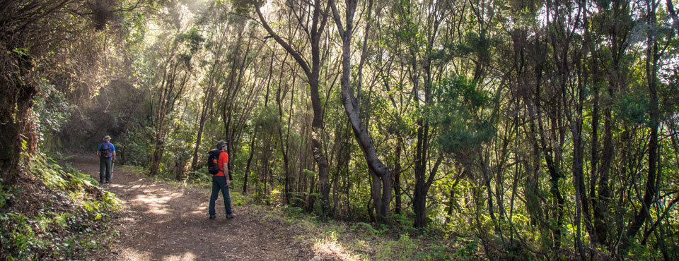
This route runs along a flat forest track with slight ascents and descents. The predominant vegetation in this area is laurel and faya bushes-heather. The hillside is populated by abundant cliff-slope vegetation, consisting mainly of Aeonium canariense, moss and lichens. A few minutes' walk away is a spring, now converted into a stone fountain. Do not take the path that ascends next to this spring. On the Las Hiedras track, there are several forks in the path. Accordingly, about 400 metres from the spring and on the left, you have the possibility of changing the direction of the route and descending to El Batán. Instead of this, the proposed route continues in a straight line. About 200 metres further on, you will also see the intersection of the path that descends from the forest house. Without leaving the track at any point, the route continues and you will find a cave refuge excavated in the rock. The trail ends at the small hamlet of El Río.
Altimetry

For your safety, don't forget to check the state of the trail.
The managing body is in charge of indicating if trails should not be used following adverse weather conditions, if they are closed or have closed stretches, etc...
- Managing body: Town Council of La Laguna
- Information of the managing body: Las Hiedras trail
![]() In case of emergency, call 112.
In case of emergency, call 112.
Download FRESS 112 available for
iOS
and
Android
Weather Today
Maximum: 16º
Minimum: 9º
San Cristóbal de La Laguna. It will rain on Thursday morning. As the hours pass by there will be showers. Temperatures will remain unchanged.