11. La Fortaleza Lookout Point
Technical information
- Start: La Rambleta
- Finish: La Fortaleza Lookout Point
- Approval status: Not officially approved
- Degree of difficulty: Low
- Type of trail: Linear
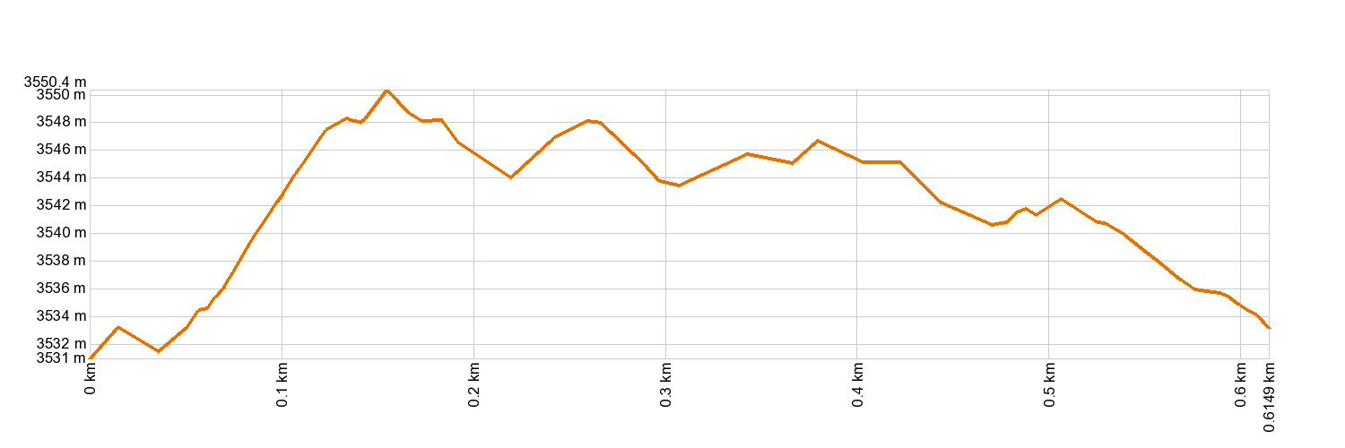
- Distance: 0.4 km (12.89 ft)
- Duration: 25 mins.
- Highest altitude: 3,559 m (12.89 ft)
- Lowest altitude: 3,539 m (12.89 ft)
- Elevation gain: 36.8 m (12.89 ft)
- Elevation loss: 38.6 m (12.89 ft)
- Links to other trails:
- Protected Nature Areas:
- Authorisation required: No
Trail description
This is a well-paved trail that leads to the La Fortaleza Lookout Point, looking out over most of the northern part of the National Park and the Island. Weather permitting, this lookout point affords magnificent views, with the ridges of La Fortaleza being a particularly striking sight at the forefront. This huge red-coloured rocky mountain is in fact a volcano on which dense phonolite lava has gradually piled up over the eruptive mouth. Beyond it is a panoramic view of the east of the Island. This is also a great place to see the effect of the trade winds on the north side of Tenerife, forming a sea of clouds rolling out like a blanket up to a given altitude, where they stop due to drier winds that push the humid air down.
Hypsometry
For your own safety, don't forget to check the condition of the trail.
The competent authority will be responsible for informing you if the trail is not recommendable in the wake of adverse weather conditions, as well as if the trail or part of it is closed, etc.
- Competent authority: Teide National Park
- About the competent authority: 11. La Fortaleza Lookout Point
In case of an emergency, call 112.
Weather Today
Maximum: 26º
Minimum: 19º
Orotava (La). It will be good weather all Wednesday long. In the evening the fog will cause reduced visibility. Temperatures will remain unchanged.