SL-TF 151.2 Ruigómez - El Tanque - El Tanque Bajo - La Atalaya
Technical information
- Start: Ruigómez
- Finish: La Atalaya
- Approval status: Approved
- Degree of difficulty: Intermediate
- Type of trail: Linear
- Distance: 6.2 km (12.89 ft)
- Duration: 2 hours 30 mins.
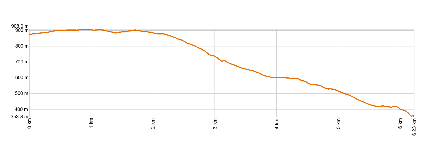
- Highest altitude: 910 m (12.89 ft)
- Lowest altitude: 338 m (12.89 ft)
- Elevation gain: 97.6 m (12.89 ft)
- Elevation loss: 638 m (12.89 ft)
- Links to other trails:
- Protected Nature Areas:
- Authorisation required: No
Trail description
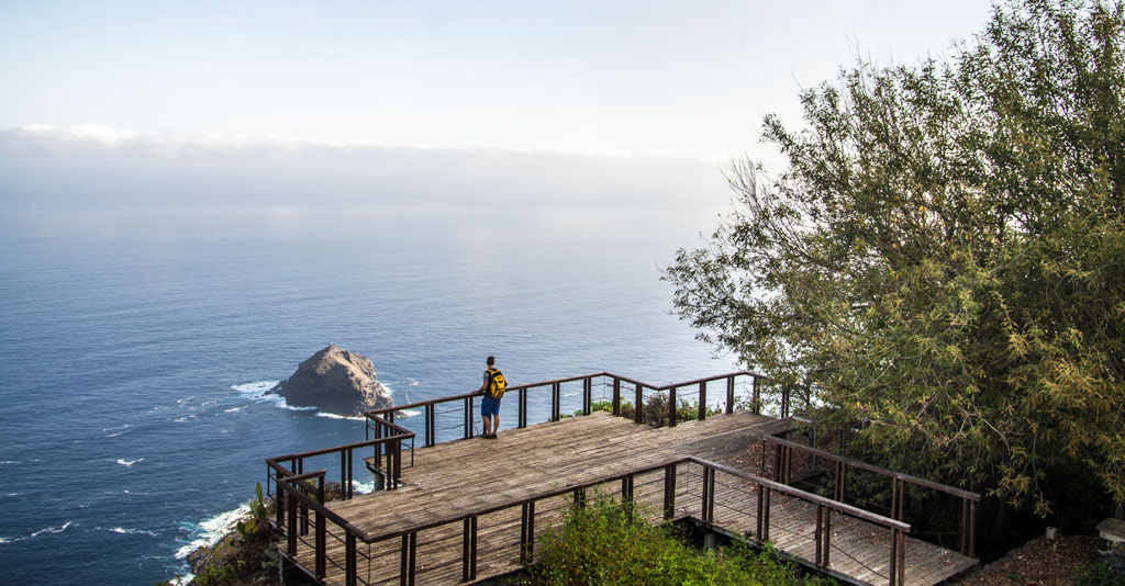
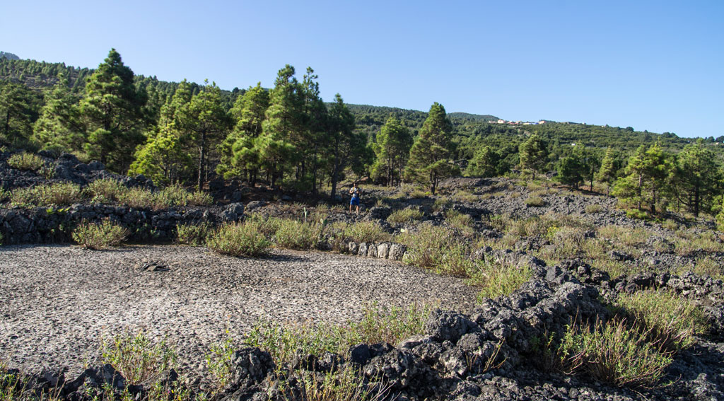
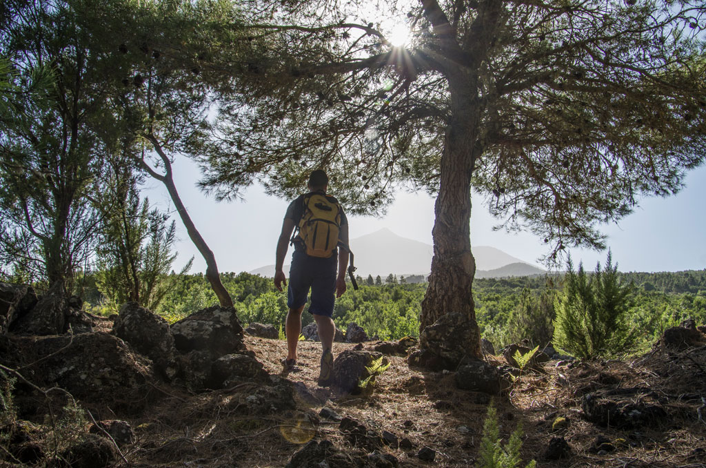
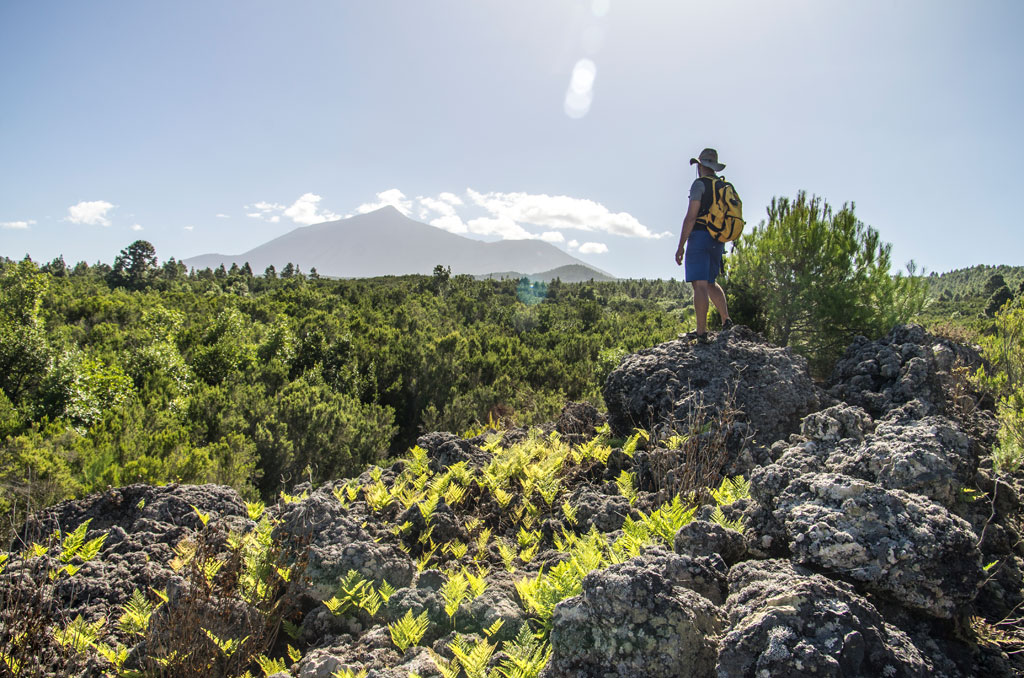
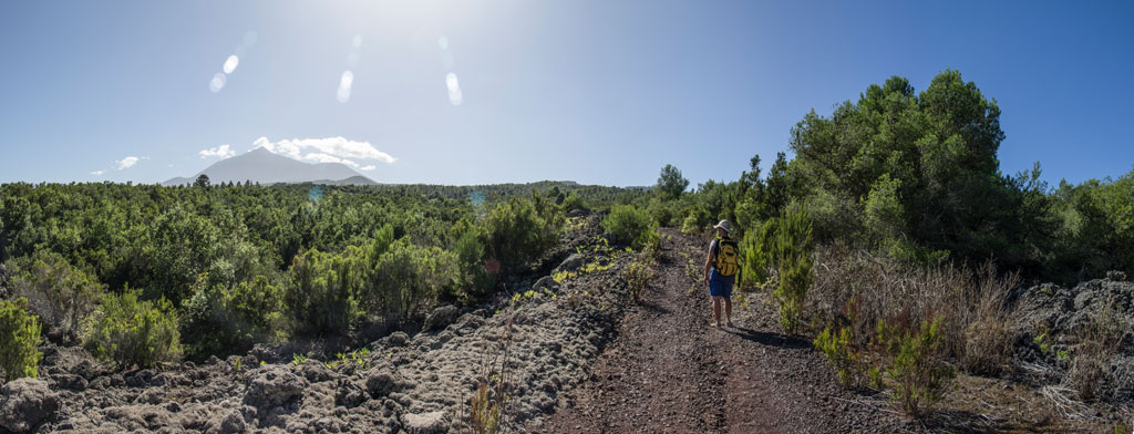
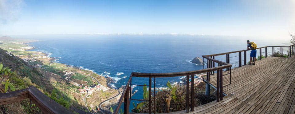
A trail that crosses the entire municipality from south to north. It will lead you into the Special Nature Reserve of Chinyero, through the centre of El Tanque and its historic quarter, and on to the La Atalaya Lookout Point, which borders with Garachico. It starts on a farmland track, walking amidst fields of crops to the Special Nature Reserve of Chinyero. You will reach Casa Canales, an old house on the hillside which still has its threshing ground and was built over tongues of lava. The house boasts an ingenious system for collecting and storing rainwater. The maze of lava tongues leads you to the area of Barrio Nuevo, where one of the municipality's most prized agro-cultural assets can be found: the threshing fields of Eras del Volcán. Walk on towards the town centre of El Tanque and, after passing the Town Hall, the trail continues along the old Mentidero Pathway, surrounded by fields of crops and grand old houses, into the historic quarter. Halfway between the square where the church of San Antonio de Padua stands and the La Atalaya Lookout Point, you will see the ruins of a wall that used to contain the dam which supplied water for the entire area. It was this hydraulic structure that gave the town its name: El Tanque, meaning "The Tank". One last short but steep downward stretch leads you to La Atalaya, one of the most breathtaking lookout points in the north of the Island.
Hypsometry
For your own safety, don't forget to check the condition of the trail.
The competent authority will be responsible for informing you if the trail is not recommendable in the wake of adverse weather conditions, as well as if the trail or part of it is closed, etc.
- Competent authority: El Tanque Town Council
- About the competent authority: El Tanque Town Council
![]() In case of an emergency, call 112.
In case of an emergency, call 112.
Download FRESS 112, available for iOS and Android
Weather Today
Maximum: 31º
Minimum: 23º
El Tanque. Variable cloudiness on Sunday morning. As the hours pass by random showers can be expected. Temperatures will remain unchanged.