Las Calderetas - Lagunetas - Gaitero
General Information
- Length: 22.00 Km
- Altitude difference: 2,200 metres in total
- Ascent: 1,100m
- Descent: 1,100m
- Highest point: 980m
- Lowest point: 1740m
- Type: circular trail
- Difficulty: medium (for mountain runners)
- PStarting point: Las Calderetas recreation area
- Coordenadas: 28.446973, -16.411849
- Places we pass through: Las Calderetas, Monte de La Esperanza, Las Lagunetas, Boca del Valle, Lomo Custodio, Mirador de Lomo Custodio, Gaitero, GR, La Vica.
- Temperaturas: in winter it can drop to below 5º (especially in Lomo Custodio), average temperature in summer
- Water points: 1 at km 16.6
Equipment
- Footwear and clothing suitable for mountain running
- Windbreaker in case it gets cold
- 1 litre of water
- Something to eat
- Mobile phone
Route description
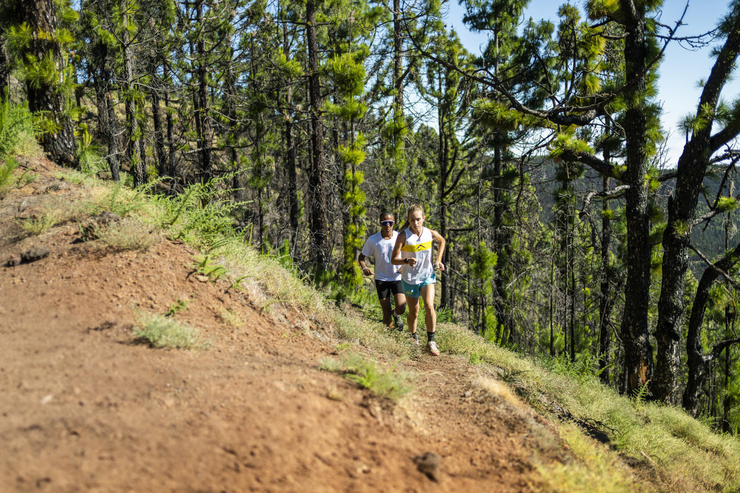
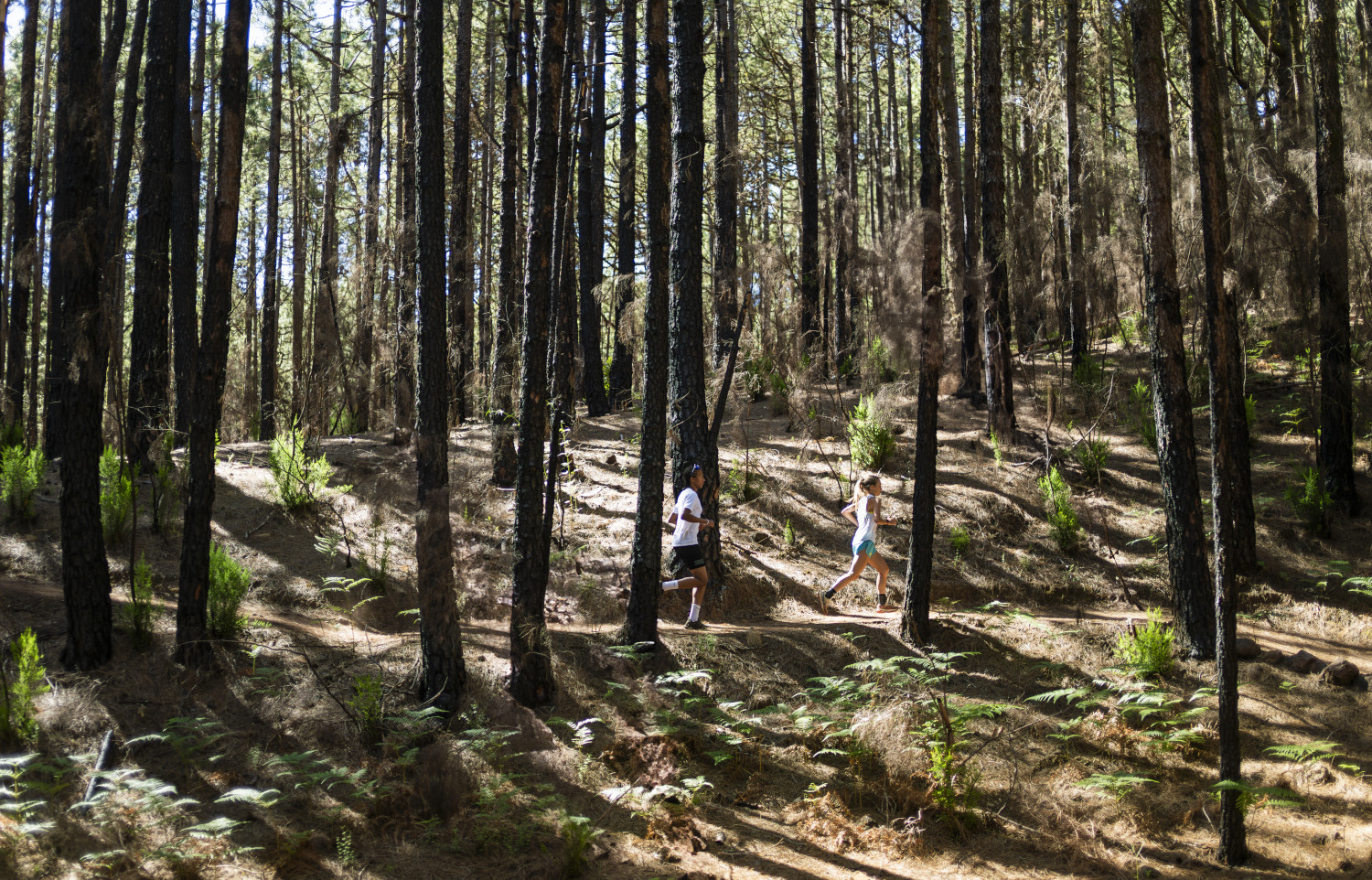
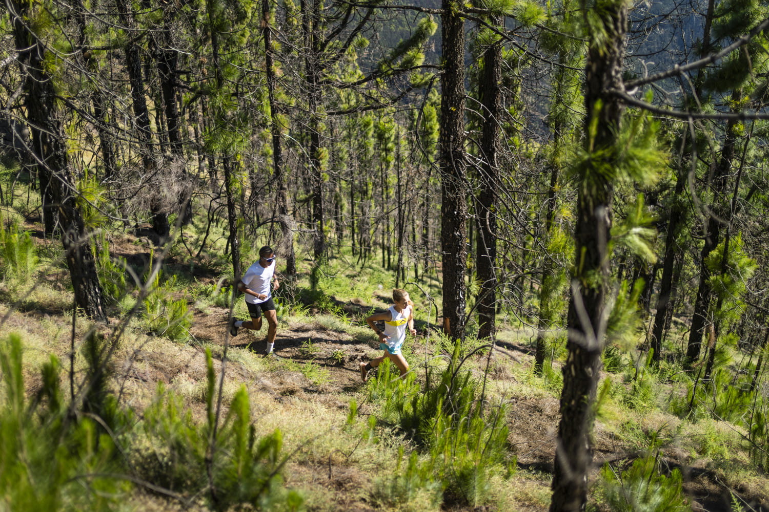
A route through the central area of the island of Tenerife, within the Las Lagunetas Protected Area. An eminently wooded landscape, characterised by gentle slopes and deep ravines. The vegetation consists mostly of Canary Island pine forests, mixed with deciduous forests (laurel and fayal brezal) and some endemic flowers, such as the geranium.
The route begins in the lower part, more precisely in the Las Calderetas recreational area. The first kilometres run through green scrubland mixed with pine forest, and gradually we come to areas where only pines grow.
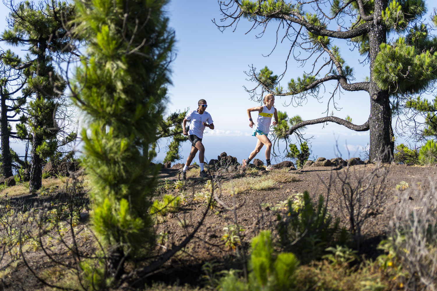
The highest part of the route goes along the island´s southern slope, where we can enjoy the view of the Güimar Valley (Boca del Valle trail). The highlight of this route is the natural viewpoint of Lomo Custodio (at an altitude of about 1680 m). On the left we can see the Anaga mountain range and the urban area, on the right the Güimar valley and at the highest point the peak of Mount Teide.
The way back is mostly along the GR-131 trail towards La Esperanza.
Course description
Highly recommended training for one to climb several uphill routes, as there will be many none-too-steep climbs that will allow us to jog, but at the same time we will have to sweat to keep up the pace.
- Km 0 We start in the Las Calderetas Recreational Area and follow the PR TF 25 towards Las Lagunetas (the path runs on the right side of the recreational area). For the first 2.5 kilometres, we will follow the PR trail markings and cross several forest paths. We will always run uphill, with moderate gradients combined with other sections, so you will certainly be able to jog most of this section
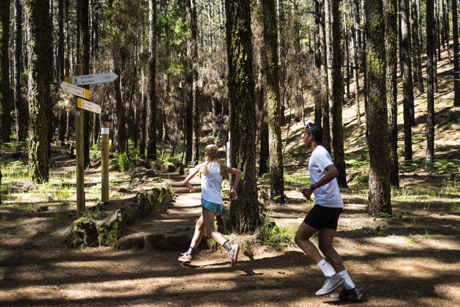
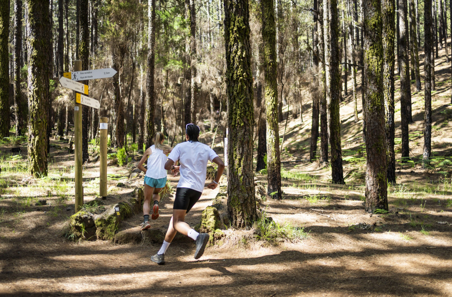
- Km 2.8 After crossing the Pino Carretón track, we shall see that the PR path has two junctions, we must continue to the right (towards Las Lagunetas). From here onwards there are some steep slopes that we will have to walk, depending on our condition, but we can use this to alternate jogging and walking, another aspect for one to be trained in.
- Km 3 There is another fork in the path: we continue to the right (signs for AR Hoya Abade and Los Nateros).
- Km 4.1 We reach a crossroad and we have to take the path to the left (signs to Las Lagunetas and AR Las Raíces).
- Km 4.8 A crossing; continue straight ahead (signs for Las Lagunetas and AR Las Raíces).
- Km 5.8 We must be careful now, because when our path crosses a wide forest track (Boca del Valle), we leave it and continue along the track on the right.
- Km 6.1 A crossing; we continue along the same path to the right (Boca del Valle). The terrain here becomes easier and we can jog comfortably.
- Km 9.5 We must be attentive, because after a descent on the dirt road, there is a bend to the right. Just before this bend, we shall see a small stone wall on the right and an ascending path. We must follow the path to enter the Lomo Custodio area. Before taking the ascending path, there is a small path on the left (not a very clear one) and we can get 30m closer to a large stone formation.
- Km 10.4 The path ends and we come to a wide path that we follow to the left; it has no exit, but it takes us closer to the natural viewpoint. So, don't hurry, take a break, and enjoy the best of this sport.
- Km 10.5 Lomo Custodio. We can rest, take photos, and enjoy the view. We must then go back the way we came, following the wide path.
- Km 12.2 We reach the Gaitero, where we see the watchtower; we continue to the left (on the asphalt).
- Km 12.5 Cross the main road and continue along the wide path to the right; a little further down the slope of the firebreak.
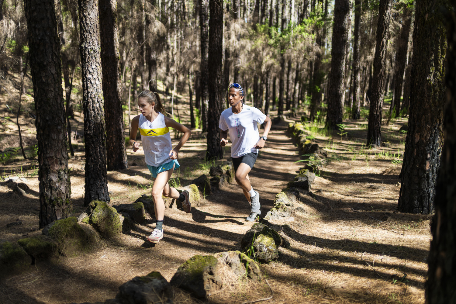
- Km 12.8 Continue to the right along the GR-131 (towards La Esperanza). We must follow the GR until km 21.5. Be careful, because part of the GR is on forest tracks and in other sections it is combined with a PR track. For some kilometres we can run downhill on a clean path and enjoy the fast running under the pine trees.
- Km 16.5 The GR leaves a path and turns into a wide trail. Now continue along a forest path following the GR signs (Punta la Pista path).
- Km 16.6 We shall see a small rest hut: to the right, there is a waterhole. You can enjoy the forest paths and jog at a good pace.
- Km 18.9 We must be careful, because we leave the track and take the left path (the GR is now combined with a white-red-yellow PR marking).
- Km 19.5 We come to a forest track (Pista Las Aguilillas) and we have to follow the indications of the GR signs, to continue on the track to the right.
- Km 21.5 We cross a PR, leave the path and follow the PR to the left, downhill (this is the path we took at the beginning).
- Km 22.0 FINISH. We have reached the starting point again
Surroundings
Paisaje Protegido de Las Lagunetas (Protected Landscape Area). A mountainous and wooded area of great value, with a large extension (3,800 hectares) that it shares with several municipalities: Candelaria, El Rosario, Tacoronte, El Sauzal, La Matanza, Santa Úrsula and La Victoria. The area lies between 790 and 1,890 metres above sea level.
Las Calderetas Recreational Area. A recreational area of four thousand metres at an altitude of 1,000 metres, ideal for nature lovers. The area has barbecue areas, tables and a children's playground.
Lomo Custodio Viewpoint. Natural viewpoint at an altitude of 1680 metres.
Recommendations
- In winter, the area is quite cold, especially above 1400m. It is advisable to bring gloves and a jacket if the day is overcast and it is cold.
- You can park in the start area.
How to get there?
- Private car.
- Take the El Sauzal motorway exit, then the country road towards "Bodegas Monje" When the steep road begins, you will reach El Ravelo. Here a paved road, the Lomo Piedras road, climbs the mountain and leads to Las Calderetas.
- Public transport.
- Bus Line 054. From La Laguna bus station (Intercambiador de La Laguna).
- Line 054
- We stay at the bus stop in the area called "Lomo Las Piedras", then we have to walk up the Lomo Piedras road (1.5 kilometres).
- NOTE: You can take bus number 54 from the bus station in Tacoronte.
Weather Today
Maximum: 24º
Minimum: 19º
El Sauzal. The sky will be covered with high and middle clouds on Saturday morning. In the afternoon the sky will be very cloudy. At night the fog will cause reduced visibility. Temperatures will remain unchanged.